Frémont’s “Discovery” of Lake Tahoe in 1844
by Mark McLaughlin
2007
 The men in Lieutenant John Charles Frémont’s command were a bit confused. They had spent the spring and summer of 1843 trekking west into the Oregon Territory (Pacific Northwest), exploring and mapping as they went. Their orders seemed clear enough. Survey the Oregon Trail by carrying a line of astronomical and barometric observations through to the Columbia River (for a possible transcontinental railroad route), and then retrace their steps back to Missouri. Why then had Frémont ordered his scruffy band of mountain men to head south, down along the eastern side of the Cascades and the Sierra Nevada on their return from the Pacific?
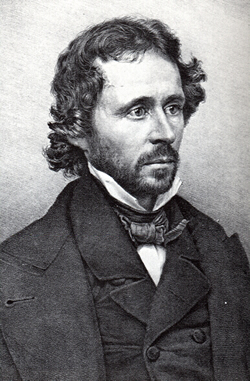
Lieutenant John Charles Frémont
Although Frémont’s motives will probably always remain a bit of a mystery, he was most likely following orders from his father-in-law, Senator Thomas H. Benton. Sen. Benton, one of the most politically powerful men in Washington, was an ardent expansionist and strong proponent of Manifest Destiny. Two years before, in 1841, Frémont had fallen in love with Sen. Benton’s 16-year-old daughter Jessie, and despite heated objections by her parents, John and Jessie were soon married. Later, the senator chose his new son-in-law, a topographical engineer, as point man for the U.S. government’s ongoing strategy of westward expansion, which included military aggression against, and forced land acquisition from, Mexico. California would be the greatest prize of all, but to get it Sen. Benton wanted Frémont to gather detailed knowledge of the western landscape, and if possible, Mexican troop strength.
Searching for a Mythical River
In his report, Frémont mentioned that he was searching for the Buenaventura River, a mythical ribbon of water that purportedly drained west from the Rocky Mountains and flowed all the way to the San Francisco Bay. The erroneous belief in the nonexistent Buenaventura River, as well as other crucial misconceptions of the region, would be corrected by Frémont’s expedition. As the men explored what today is western Nevada, it quickly became obvious that the Sierra Nevada range blocked the possibility of any westbound river from reaching the Pacific Ocean. There were an assortment of maps of the region available before 1843, but ultimately it was Frémont’s explorations that produced the first reliable maps of the West and placed Western cartography on a scientific foundation. Frémont was also the first to comprehend that all the rivers in this region of the country fail to reach the sea and evaporate in desert sinks, inspiring him to name it the “Great Basin.”
 Frémont’s abilities at mapping the wilderness left a legacy of noted topographic landmarks in the Far West. Frémont and his band of hardy men, which included the famous scouts Christopher “Kit” Carson and Thomas “Broken Hand” Fitzpatrick, spent December 1843 wandering south through present-day northwestern Nevada. Frémont’s mission was ostensibly scientific, but it had taken on a decidedly militaristic character due to an imposing wheel-mounted, 12-pound mountain howitzer they hauled along with them. Frémont had requisitioned the cannon as protection against Indian attack. The weapon proved to be more of a burden than an asset. It was only fired to celebrate holidays. Frémont wrote, “We were roused, on Christmas morning, by a discharge from the small arms and howitzer.
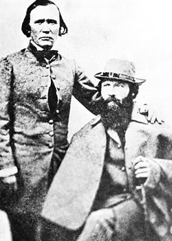
Christopher “Kit” Carson and John C. Fremont (?)
Always, on days of religious or national commemoration, our voyageurs expect some unusual allowance; and, having nothing else, I gave to them each a little brandy, which with some coffee and sugar was sufficient to make them a feast.”
Chief Truckee's Directions Ignored
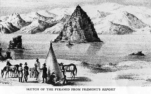 When the expedition reached the body of water at the terminus of the Truckee River, Frémont named it Pyramid Lake in honor of the triangle-shaped rock island located on the lake’s eastern side. When he observed monstrous 40 pound Lahontan cutthroat trout swimming in Pyramid Lake’s feeder stream, he called it the “Salmon Trout River,” later re-named the Truckee by the Stephens Party in 1844. Near Pyramid Lake Frémont met the friendly Paiute Indian, Chief Truckee, who explained that if they followed this river they would come to a lake. Cross the mountains (Sierra Nevada) and the men would reach two rivers flowing west. Chief Truckee was describing the Truckee River, Donner Lake or Lake Tahoe, and the American and Yuba rivers. But unlike the Stephens Party, which took Chief Truckee’s advice and successfully followed these river systems west into the Sacramento Valley, Lt. Frémont ordered his men south, along the eastern escarpment of the Sierra Nevada range.
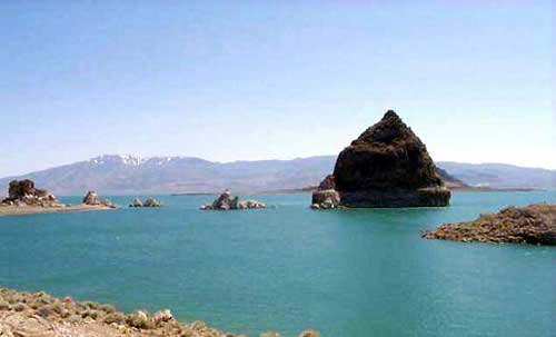 Pyramid Lake Today
New Year’s Day 1844 came and went with Frémont and his twenty-three men struggling through the bleak and frigid landscape, with the gloom of a persistent pogonip (frozen fog) obliterating the horizon. Frémont wrote, “The result of our journey began to be very uncertain; the country was singularly unfavorable to travel; the grasses being frequently of a very unwholesome character, and the hoofs of our animals were so worn and cut by the rocks, that many of them were lame, and could scarcely be got along.” At that point, Frémont realized that there was no way that the animals could make it back to the Rocky Mountains so he decided to cross the Sierra Nevada into California.
Searching for a Pass
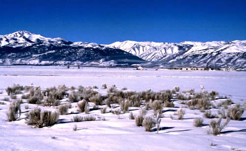
Bridgeport Valley
In his search for a pass over the Sierra, Frémont led his men as far south as Bridgeport Valley, crossing the Carson and Walker rivers. (Frémont named the Carson for his guide Kit.) Despite the dangerous weather conditions in the mountains, Lt. Frémont was determined to cross the mountains. One old Indian warned them that, “Even if you get over the snow, you will not be able to get down from the mountain.” Another Native who had been hired as a guide deserted. Undeterred, Frémont directed his men to fabricate snowshoes modeled after the design used by the local Indians; a simple hoop, about a foot in diameter, with the interior space filled with an open network of bark.
Their first attempt into the mountains followed the Walker River, but the rugged and broken country made the trip impossible. On January 29, the heavy cannon was abandoned on the West Fork of the Walker. Due to the extreme difficulty of this route, Frémont consulted with a few Indians who then led the expedition to the East Fork of the Carson River where they camped for the night. While there, other Indians approached the camp to inform Frémont that it was “six sleeps to the place where the whites lived,” but that the journey could only be made in summer.
Ignoring More Warnings
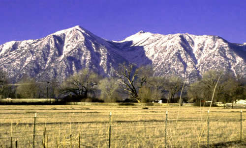
Carson River drainage
Despite the warnings, the men were resolved to reach the safety and comfort of the Sacramento Valley. The men rigged sleds to carry their ever-decreasing supplies of food and equipment and began climbing up the east fork of the Carson River. Their situation was critical. Frémont wrote, “We suffer much from the want of salt; and all the men are becoming weak from insufficient food.” They took turns breaking trail on horseback; when the snow became too deep, they pushed forward on foot. To make a path for their pack animals, they were forced to pound down the snow with hand mauls. Burdened with cumbersome scientific equipment and a bulky collection of minerals and plants gathered during their exploration, the men, horses and mules were soon exhausted. Frémont wrote, “…we attempted in the afternoon to force a road, but after a laborious plunging two or three hundred yards our best horses gave out, entirely refusing to make any further effort. The guide informed us that we were entering the deep snow and here began the difficulties of the mountain; and to him and to almost all, our enterprise seemed hopeless.”
Occasional snowstorms plagued them, as did bouts of snow blindness, which they tried to mitigate by wearing scarves over their eyes. On Feb. 6, Charles Preuss, the expedition’s German topographer, wrote in his diary, “The snow is so horribly deep, and we can cover only a few miles each day. I am walking almost barefoot. This surpasses all the hardships that I have experienced until now.” Two days later, they get their first view of the Sacramento Valley, some thirty miles away. Kit Carson recognized Mount Diablo, 100 miles distant, from overland his exploration of California fifteen years before via the Mohave River. The promise of reaching the lush green valleys of California buoyed everyone’s spirits and it came just in time. Their food supply was dwindling rapidly. In fact, on Feb. 13, Frémont wrote, “We had tonight an extraordinary dinner—pea soup, mule, and dog.”
They Happened Upon a Mountain Lake
On February 14, 1844, Valentine’s Day, Frémont and Charles Preuss, climbed the dividing ridge of the Sierra crest where they “discovered” Lake Tahoe, about 20 miles to the north. History records them as the first Euro-Americans to see the magnificent lake, but celebrated trapper, Stephen C. Meek, claimed to have been the first Caucasian to see the Truckee River when he set traps on it in 1833. It seems unlikely that Meek would not have followed the relatively short Truckee River to its source, Lake Tahoe. Ironically, if Frémont had been successful in ascending the Walker River drainage, he would have never seen Lake Tahoe.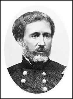
Indicative of the stress and danger they were facing in their mid-winter mountain crossing, Preuss didn’t even mention Lake Tahoe in his daily notes and Frémont also treated the event very casually. Frémont’s comments offer a glimpse of that moment: “With Mr. Preuss, I ascended today the highest peak to the right [Red Lake Peak]; from which we had a beautiful view of a mountain lake at our feet, about fifteen miles in length, and so entirely surrounded by mountains that we could not discover an outlet.” But on other occasions, Frémont did fall under the spell of the High Sierra.
Lieutenant John Charles Frémont
He wrote, “Scenery and weather combined must render these mountains beautiful in summer; the purity and deep-blue color of the sky are singularly beautiful; the days are sunny and bright, and even warm in the noon hours; and if we could be free from the many anxieties that oppress us, even now we would be delighted here; but our provisions are getting fearfully scant.”
Two more weeks of struggling through rugged canyons and deep Sierra snow finally brought the weary expedition into the Sacramento Valley, and on March 6, Lt. Frémont and his men stumbled into Sutter’s Fort, where John Sutter treated them like royalty. Despite their ordeal, not one man had been lost.
Mountain Lake, Lake Bonpland, Da ow a ga, Bigler, Lake Tahoe
In his 1845 report, Frémont called the largest lake in the Sierra Nevada “Mountain Lake,” while Preuss’ map of 1848 identifies it as Lake Bonpland, in honor of the legendary French botanist Amie Jacques Alexandre Bonpland. Although the name Tahoe, derived from the Washoe tribal name, Da ow a ga (“edge of the lake”) was in common use by the 1860s, the lake was officially renamed Bigler in 1854. (John Bigler, third governor of California, had personally led a rescue party from Placerville over Echo Summit to save a group of snowbound emigrants in 1852.) Bigler was the official name until 1945, when the lake was at last legally established as Lake Tahoe.
John Charles Frémont enjoyed remarkable fame in the 19th century, enough to run as the GOP candidate for president of the United States in 1856, although he lost to Democrat James Buchanan. Considered the preeminent explorer of the uncharted American West, Frémont was known as the “Pathfinder,” although one biographer more correctly called him the “Pathmarker.” Much of his incredible popularity was based on the official reports that he wrote up after his expeditions. Since the salary of a second lieutenant did not permit the luxury of a secretary, Jessie Frémont collaborated with her husband in drafting the reports. In fact, it was really Jessie who turned out such splendid prose that the government reports were then edited and published. They became best-selling books among an American public enthralled with the Wild West. Frémont’s scientific reports became literary classics, thereby inspiring countless Americans to follow the paths west. Jessie Frémont later wrote, “From the ashes of his camp fires have sprung cities.” 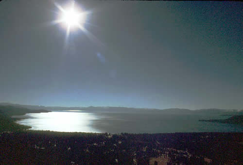
Lake Tahoe Today
Photo Credits
— John C. Frémont, portrait, younger: Lithograph by Francis D'Avignon, after Mathew Brady photograph, c. 1860, National Portrait Gallery, Smithsonian Institution, Washington, D.C., ID: NPG.69.68. This image was originally part of Mathew Brady’s exhibit “Gallery of Illustrious Americans.”
—
Frémont and Carson: scanned from Frontispiece to Blanche Chloe Grant, Kit Carson’s Own Story of His Life. Taos, New Mexico, 1926. Facsimile reprint by Santa Fe, New Mexico: Sunstone Press, 2007. This image is in some dispute. For decades it has been believed to be an image of Carson (standing) and Frémont (seated) c.1850. Many recent articles and books use the image and state that it is Carson and Frémont. However, many scholars now believe it is actually an 1862 image of Carson and Edwin Perrin (seated), who was a military colleague of Carson. This image is found in many repositories, including the Collections of the Denver Public Library.
—
Pyramid Lake Drawing from Frémont’s Report: Drawing by Charles Preuss, found in John C. Frémont, Report of The Exploring Expedition to The Rocky Mountains in the year 1842 and to Oregon and North California in the years 1843-44. Washington: U.S. Senate, 1845. Lithographs by E. Weber & Co., Baltimore, Maryland.
— Frémont, portrait, older: “Maj. Gen. John C. Frémont, USA,” Library of Congress, Washington, D.C., ID: pga04582, LC-DIG-pga-04582