Tahoe's Drowned Forest
by Mark McLaughlin
Tahoe Nugget #189: September 4, 2010
Lake Tahoe's water level is falling back into the red zone this summer, with at least two boat launching facilities already closed by Labor Day. After last winter's great ski season, many believed that regional drought conditions were over, but now hydrologists are warning that once again water levels are likely to fall below the lake's natural rim. What gives?
Last year's El Niño-influenced winter consistently delivered enough snowfall to produce some of the best skiing and snowboarding conditions in years. The active weather pattern, along with some aggressive price reductions for season passes, helped increase skier visits which boosted the bottom line at many local resorts. Finally, a damp, cool spring with several powerful winter-like storms delayed the snow melt, extended the ski season, and pushed peak stream and river flow into early summer. In the final analysis, however, the actual water content in the Tahoe Basin snowpack was insufficient to overcome three previous below average winters.
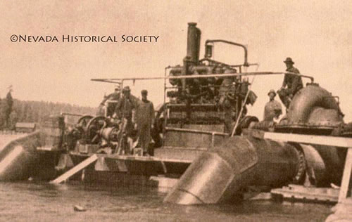
In 1934 large pumps moved water from Lake Tahoe into the Truckee River.
Lake Tahoe Dam
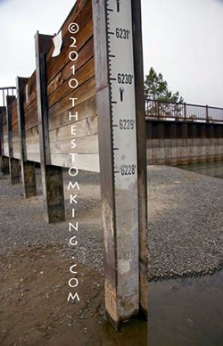
Lake Tahoe is a reservoir controlled by the dam at Tahoe City with water storage equal to six feet and one inch. There is a federal limit on the maximum level of the lake so that it may not exceed 6,229.1feet in elevation, but when the lake drops to 6,223 feet no more surface water can feed into the Truckee River.
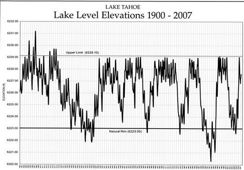
Over the past century, Tahoe's water levels have fallen below the natural rim during several severe droughts.
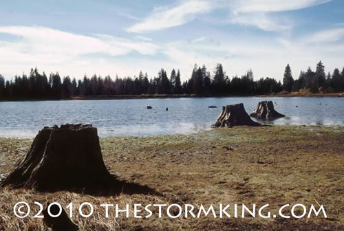
During times of drought, Tahoe's low levels affect boaters, wildlife, and water management. Dry spells have always impacted the region, some worse than others. During a severe drought in the early 1930s, Tahoe's surface level fell below the rim and exposed tree stumps off the beach near South Lake Tahoe. A University of California at Berkeley scientist, Samuel T. Harding, examined the stumps and determined that they had lived for 100 to 150 years before rising water levels submerged them.
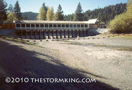
In 1988 Lake Tahoe's water failed to reach the dam.
The tree stumps Harding analyzed are between 4,846 and 5,527 years old; other stumps have been found deeper in the lake from Emerald Bay and Fallen Leaf Lake to Stateline. They range up to seven feet tall, three and a half feet in diameter, and up to 6,300 years old. The existence of the ancient trees suggests that between 4,000 and 5,000 years ago a much drier climate forced Lake Tahoe's water level to fall well below the natural rim for at least 1,500 years.
The Last 4000 Years
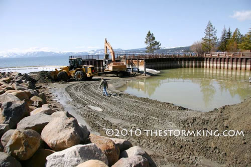
This spring crews dredged out the Tahoe Vista boat ramp. Despite their efforts, it was closed again in August.
Eventually wetter and cooler conditions returned and for about the past 4,000 years the climate in the west has stabilized. During this period of relatively warm and wet weather, Tahoe's water level has stayed relatively high, which has preserved the tree stumps and prevented them from rotting away. One theory suggests that seismic activity may have quickly raised or lowered portions of the lake bottom, which could have affected water levels, but most scientists think that climate change is the more likely culprit.
Harding also argued that the sand dunes near Kings Beach could only have formed if Tahoe's water levels were much lower because the dunes are too high to be formed under today's conditions. For wind to build dunes that large, a much wider beach and larger source of sand would be required.
Tahoe's water level is going down, down, down.
Droughts Happen
Tree trunks exposed in low water conditions.
Extreme droughts that occurred thousands of years ago don't seem too threatening today, but there is plenty of evidence that desiccating dry spells are still part of our contemporary climate regime. Over the past 20 years, paleoclimatologist Scott Stine of California State University — Hayward has analyzed tree stumps he located in Mono Lake and the Walker River. His studies using tree ring and radio-carbon methodologies have found two prolonged dry spells that occurred between 1200 and 600 years ago; one lasted for 220 years and another for 141 years.
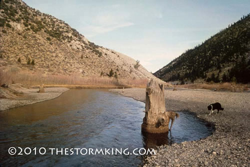
Ancient tree stumps once grew where Walker River now flows.
During those mega-droughts, many lakes and rivers in the Sierra Nevada dried up for decades, a disastrous scenario that makes complaints about closed boat launch facilities seem trivial by comparison. The period of modern settlement in the Sierra Nevada (about the last 150 years) has been one of the wettest intervals of the past 1,000 years. We can only hope that it stays that way.
Photos not credited were taken by Mark McLaughlin