Saltwater City [San Francisco] Seeks Freshwater Partners for Lasting Relationships
by Rick Heide
Author, Editor
Water, water every where
Nor any drop to drink
— Samuel Taylor Coleridge, The Rime of the Ancient Mariner, 1798
A pervasive stereotype of sailors is that they are hard-drinking people. Yet these oft-quoted lines from an epic poem relate to a different type of “drinking problem.” Instead, the long-ago sailors in the poem faced a life-and-death dilemma on the high seas near Antarctica. A dilemma of elemental thirst.
San Francisco’s “Drinking Problem”—Would You Like Salt with That?
These poetic lines, however, could also apply—with some exaggeration and some contemporary controversy—to the [also notoriously-hard-drinking] City of San Francisco. For one of the world’s most-beloved cities can boast a lot of waterfront, an absolutely-essential part of its great attractiveness. Yet all of its miles of seashore and bayshore, lining the heart of the city, are along waters much too salty to drink.
San Francisco is a city where many people have lyrically left their hearts, including the ever-smooth-and-culturally-relevant 85-year-old singer Tony Bennett, recently releasing an album of duets with Lady Gaga(!). But the physical heart of the city itself is located on the tip of a peninsula. There it is surrounded by water on three of four sides. About 80 percent of the edges of the mainland of the City of San Francisco touch San Francisco Bay, the Golden Gate, or the Pacific Ocean, all of them saltwater. Of its borders, only a just-under-6-mile-line, dividing it from San Mateo County to the south, is on land. I think it is fair to say that very few of the world’s major cities have such a preponderance of saltwater shoreline. The city could aptly be nicknamed Saltwater City.
This preponderance of salty shore does not even include the Bay islands that are officially part of San Francisco. They range from part of tiny Red Rock Island, to small-yet-world-famous Alcatraz, to mostly-human-made Treasure Island, and to now-lush-green Yerba Buena, which earlier lent the city its name and now anchors the mighty San Francisco-Oakland Bay Bridge. All these islands, of course, are surrounded by Bay saltwater. Then—out in the even-saltier Pacific Ocean, far from what we consider the edge of the city—the rocky Farallon Islands are also part of San Francisco.
Some Really Ancient Bay Area Water History
Though few San Franciscans have ventured to the faraway Farallones, they are certainly part of the city’s multi-layered mystique.
Of the countless books set in San Francisco, be they fiction or non-fiction, few explore the length and breadth of the city more intensively, or lovingly, than Gary Kamiya’s 2013 work, Cool Gray City of Love. Informed by walking virtually every block of “The City” (as many long-time locals proudly-and-somewhat-provincially refer to it), Kamiya happily strolls from past to present in 49 chapters, telling many of “The City’s” stories. But for one of his walks, he had to start out with a fairly-long boat ride.
In our times, when the fog lifts, many San Franciscans and other Bay Area residents like to find a vantage point to try to spy the Farallones, those islands 28 miles west of the Golden Gate. Amid often-treacherous seas, they are home to an amazing array of non-human life. And though small and far away, the islands are also fairly tall in places, aiding their occasional visibility from the mainland. The highest peak on the Farallones, Tower Hill, rises rapidly from the ocean to 348 feet above sea level, only 28 feet less than Nob Hill (which, of course, has its own commanding views). Officially part of the City and County of San Francisco—the City and County are legally one and the same—the Farallones are the only land between the Bay Area and the Hawaiian Islands, over 2,000 miles to the west. In fact, the Bay-Area standard for a very-clear day is being able to see the Farallones.
It was, however, not always thus. Gary Kamiya writes of a time when San Francisco Bay was still a valley [named the Franciscan Valley by modern scientists]. A river of fresh water flowed through it, eventually to the sea, and the Farallones were not yet islands.
The first humans arriving in the land we call the Bay Area, about 13,000 years ago, witnessed a valley with a bestiary that sounds almost fictional from our perspective. Those Paleo-Indian people, writes Kamiya, encountered the last millennium or so of “a pageant of wildlife so extraordinary that the archaeologist E. Breck Parkman calls it ‘one of the greatest natural phenomena of all time.’ ”
The Paleo-Indian people of roughly 12,000 to 13,000 years ago found a Franciscan Valley [now Bay] where hundreds of American lions (much bigger than today’s African lions) and terrifying 13-feet-tall short-faced bears were high on the “food chain.” Mastodons (the forerunners of modern elephants) and huge Colombian mammoths roamed what is now the Bay Area. It was a time when it is estimated that more than 225,000 bison (4,000-pound-and-8-feet-tall Giant Bison, at that), 35,000 horses (some of them Giant Horses), and 7,000 camels, yes camels, lived in today’s Bay Area.
Those earliest humans to reach Northern California could then walk westward 28 miles, hopefully dodging the predators, from the site of today’s city. They could walk along the Farallon Plain all the way to today’s Farallon Islands, which then were still part of the mainland, at the western edge of North America. Today’s downtown San Francisco was a bit over 30 miles inland from the Pacific Ocean. All of what we think of today as San Francisco was nowhere near the Pacific Coast back then.
Then, over several thousand years, the big animals died out, many glaciers melted, the ocean rose, and the continent’s coastline receded eastward, eventually inundating the Farallon Plain. Over a 3,000-year period, the Franciscan Valley filled with water and became San Francisco Bay. Lush marshlands started to emerge all around the Bay. Shell mounds found in the East Bay, at Emeryville and Newark, indicate that Native people were present from, at least, about 4000 B.C.E.
Roughly between 4000 and 2500 B.C.E., the San Francisco landmass became basically—at least in water-to-land juxtaposition—the Ocean-side, Golden Gate-side [to coin a phrase], and Bay-side tip of a peninsula we know today. It became, essentially, the mostly-surrounded-by-saltwater city-site familiar to us.
Gary Kamiya writes that, certainly by 2500 B.C.E., the Bay was “completely transformed” into a “super-rich food environment, with oysters, clams, mussels, fish, and waterfowl easily available.” As Kamiya describes it:
Before this time it’s unlikely that more than a few people lived permanently on San Francisco Bay. They probably came to the great estuary to collect shellfish or ducks, then moved on to warmer and more food-rich places in a migratory pattern…. But when word got out that a vast free shellfish restaurant had opened its doors off Hunters Point and Mission Bay [both in San Francisco], and Ellis Landing in Richmond, and West Berkeley, more and more people began to settle permanently or semi-permanently on the bay.
Most of the Native people in the area decided to live in the much-sunnier East Bay. But a few chose to live in what Kamiya calls “the cold, windy, hilly, sandy peninsula on the west side.” For 4,000 to 5,000 years, up to a few hundred Native Californians would live in San Francisco, with their traditional way-of-life enduring, until at least the late 1700s. Apparently these early San Franciscans engaged in extensive trade—based on their saltwater bounty as their main trading commodities—with tribes and bands to the north, east, and south. From that time on, Kamiya tells us, San Francisco would be continuously populated.
(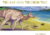 A much more thorough treatment of Bay Area natural history, from ancient to contemporary times, will be available in July 2015. Heyday Books of Berkeley will be publishing The Bay Area Through Time, authored and illustrated by Laura Cunningham. Among much other published work, Laura Cunningham has created beautiful color illustrations of how a restored Hetch Hetchy Valley might appear in the future under different scenarios. They appear in a recent Heyday book, Hetch Hetchy: Undoing a Great American Mistake, by Kenneth Brower and are found elsewhere in this journal.
“The Ohlone Way” On the Bay
From about 1,500 years ago, beginning in roughly the 6th Century C.E. [or A.D.], the main Native dwellers on the Bay became bands of the Ohlone people. They came from the east and may have displaced the Esselen people, who were pushed further south toward the Big Sur area below Monterey. For many centuries since then, the Ohlones lived in a large area around San Francisco Bay and Monterey Bay. There were about 40 distinct bands of Ohlone people, “each with their own territory and their own chief,” and speaking up to a dozen languages, according to noted California author, historian, and publisher Malcolm Margolin.
[Full disclosure: Malcolm is the founder and publisher of Heyday Books of Berkeley, now celebrating its 40th year as probably the most-outstanding regional press in the United States. Heyday is also our publishing partner here at Sierra College Press. And, personally, he has been my dear friend, co-publisher, colleague, and co-worker for about 35 years now. Not that I—or my colleagues at SCP who also admire him—are biased on the subjects of Malcolm, his co-workers, or Heyday…]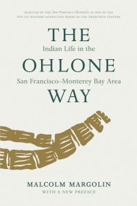
Chosen by the San Francisco Chronicle as one of the finest non-fiction works in the entire literature of the American West, Margolin’s The Ohlone Way was first published in 1978. It is a seminal work on the Ohlone people and their land. In it, Margolin cites an early explorer who refers to the Ohlone homeland on San Francisco Bay as one of “inexpressible fertility.” It was a land where geese, ducks, and other birds would rise from the huge marshes, forming a large cloud “with a sound of that like a hurricane.”
Margolin describes a land “where people were few and animals were many.” Still, in those years before European settlement, the rich lands on the Bay easily sustained a large human population, by the continental standards of that era. As Margolin begins his book:
Before the coming of the Spaniards, Central California had the densest Indian population north of Mexico. Over 10,000 people lived in the coastal area between Point Sur and San Francisco Bay.
Some observers have put the total Ohlone figure as high as 20,000 at the beginning of Spanish settlement. Yet, among those 40 bands, or “tribelets” to use Margolin’s term, the San Francisco Ohlone seem to have been among the lesser in population, only a tiny percentage of the 10,000 to 20,000 Ohlones. Relatively cold, sandy, and windy, San Francisco’s days as a major population center, even within the Bay Area, were yet to come. Did better sources of fresh water in other areas around the Bay perhaps also play a part? At any rate, it was, even in the Ohlones’ over 1,000-year heyday, still a small town.
The Ohlone Way is a beautiful and lyrical celebration of the Ohlone way-of-life. In it Margolin writes:
[T]hey lived in a world where the animal kingdom had not yet fallen under the domination of the human race and where (how difficult it is for us to fully grasp the implications of this!) people did not yet see themselves as the undisputed masters of all creation. The Ohlones, like hunting people everywhere, worshiped animal spirits as gods, imitated animal movements in their dances, sought animal powers in their dreams, and even saw themselves as belonging to clans with animals as their ancestors. The powerful, graceful animal life of the Bay not only filled their world, but filled their minds as well.
I think it would be fair to say that the Ohlones also had similar feelings about commingling, coexisting, and having a respect and rapport with natural elements like land and water.
How different their outlook toward animals, land, and water would be from the majority cultures to come! These differences in world-view—between the Ohlones and those who settled along the Bay from the 1770s to 1848—were fairly big.
From 1849 to our present day, however, the attitudinal differences of “modern” residents from “The Ohlone Way” have been akin to a vast, gaping chasm. By the 1860s, most of the Bay Area’s abundant animal life was wiped out. And also by the 1860s, Bay marshlands were already starting to be replaced by landfill. This would be a century-long process that eliminated about one-third of San Francisco Bay, before an environmental movement to “Save the Bay” started to severely limit added landfill in the 1960s. In addition to building whole new neighborhoods on landfill, like the Marina District and parts of downtown, San Francisco waterways and rich aquatic habitats like Mission Bay were essentially “paved over.” San Francisco Bay would become home to millions of people, quite a few of them living on “reclaimed” bay or marshland.
But, before the late 1700s, the Ohlone could not, even in their most fevered dreams, imagine this transformation of their homeland.
San Francisco, and the Bay, Are Finally “Discovered”
About 1,000 years after the Ohlones moved into the San Francisco Bay Area, the Juan Cabrillo expedition of 1542, sailing out of western New Spain [today known as Mexico], became the first known Europeans to explore the California coast.
The Spanish Empire at that time was immense. In terms of land claimed, it put the much-earlier Roman Empire to shame. Only 50 years after Columbus’ first voyage, Spain claimed many New World lands. These included most of the continent of South America, most of Central America and the Caribbean, and Florida. Their claim to New Spain was even bigger than today’s big nation of Mexico. For it also then included both Texas and New Mexico “writ large,” forming most of today’s U.S. Southwest.
Cabrillo sailed up-and-down the coast, making several landings, in today’s California. And, given the bent of Spanish explorers over the prior 50 years, he naturally claimed it for Spain. But for several reasons mentioned in David Kuchera’s article in this journal, Spain did not start to settle our current U.S. State of California for 227 years. For a very long time, Europeans would also think of the Californias (Alta California, today’s U.S. state, and Baja California, Mexico’s peninsular state) as a big island. If they could get far enough north, they expected to find a Northern Passage through the presumed Straits of Anián, a “short-cut” between Asia and Europe that was, of course, never found.
While other coastal tribes and bands in California suffered occasional contact with European voyagers over the next two centuries, the Ohlone of San Francisco Bay were luckier than most. Over those many years, Spanish ships landed at nearby Monterey Bay, peopled by southern Ohlone people. And the English privateer/explorer/pirate Sir Francis Drake probably landed in the Coast Miwok territory we know as Marin County, only a few miles north of the Golden Gate.
But two natural phenomena helped “hide” San Francisco Bay until 1776, 234 years after the Cabrillo expedition. The Bay even remained hidden, despite 200 years of Spain’s “Manila Galleons” frequently sailing along the California coast, on their treks to-and-from the Philippines. One factor protecting the Bay Area Ohlones was the frequent fog that hovered along the coast. The other was the narrow opening to the huge bay that we know as the Golden Gate. The physical features that would make the San Francisco Bay one of the world’s best natural harbors helped protect the Ohlone from the depredations of European visitors. They also kept the Ohlone from the diseases the Europeans unwittingly brought with them, for which the Native people lacked immunity.
Once the Gaspar de Portola expedition spotted the magnificent harbor in 1776, the Spanish wasted no time in setting up a mission—now known as Mission Dolores in today’s San Francisco Mission District—and a Presidio [fort] to guard the harbor from other European powers. As elsewhere in California, and the New World in general, European settlers caused a fairly-quick death knell for the majority of Ohlone people.
Without a reliable census, we cannot know the extent of the Ohlones’ devastation between 1769 when the mission at Carmel was established—the first in their southern territory—and 1800. Estimates of their population, before Spanish settlement, range from 10,000 to 20,000. Estimates of their 1800 population seem to mostly hover around 3,000. Thus Ohlone population, in just three decades after Spanish people came to live in their land, declined by about three-quarters, between 70% at the low end and 85% at the high end. Tragically, this was not an unusual New World pattern, and some cases were even worse, leading to the rapid total extinction of many tribes.
As Margolin writes in The Ohlone Way:
The death rate at the missions was horrendous. At Mission Dolores, in San Francisco, for example, 300 or more Indians out of a population out of about 1,000 might die during a severe epidemic year. And while people died, some almost daily, the number of births dropped drastically. … In 1806, when a measles epidemic took over 300 people at Mission Dolores, there were only twenty-three infants born alive.
In terms of freshwater resources around the Bay, however, there was relatively little change from Ohlone-era patterns during the Spanish and Mexican eras. It is doubtful that many more than 1,000 non-Ohlone settlers lived anywhere near San Francisco Bay. So freshwater supplies, for the most part, seem to have been able to meet human needs of a smaller population. At least that would be true until—in the words of the great California historian J.S. Halliday made famous—“The world rushed in.”
But even fairly early in the Mexican era, San Francisco may have already become a partial exception to this general Bay Area rule.
At least as early as 1832, when the city’s population was only a few hundred, fresh water in casks was already being imported to San Francisco. It appears that the one-or-two-dozen soldiers of the old Mexican fort, the San Francisco Presidio, were importing water in the early 1830s, long before the Gold Rush. It was coming in by sailboat from across the Bay, hardly an efficient delivery system.
An enterprising young Irish-born Mexican citizen, John Thomas Reed, would be given a huge Marin County land-grant, build a sawmill to process the abundant redwood timber, and establish the little town of Mill Valley. But before that, according to the Mill Valley Historical Society, Reed earned part of his living by ferrying water across the Golden Gate. He delivered casks of fresh water from Sausalito creeks, by boat, to the Presidio soldiers.
Though only a metaphorical trickle in 1832, San Francisco’s history as a water-importer had begun. And, within two decades, the city would begin importing water in much-larger quantities.
San Francisco’s Drinking Water Proves Unhealthy, Even in the Earliest Days of the Gold Rush
Less than a year before gold was discovered in California, newly-named San Francisco (called Yerba Buena under Spanish and Mexican jurisdiction) had still been a tiny hamlet. The California Star, an early San Francisco newspaper, reported in August 1847 that the city’s population was 459. And, presumably, that even included a few people living in present-day San Mateo County. (That then-sparsely-populated rural area would not be legally separated from San Francisco until the new County of San Mateo was formed in 1856.)
Just over two years later, by the end of 1849, The Annals of San Francisco estimated the city’s population at between 20,000 and 25,000.
As for the Ohlone, Margolin writes “With the coming of Anglo settlers things grew even worse.” Despite their faults, the Spanish saw Indians “as fellow human beings with souls to be saved.” He continues:
In the eyes of the Spaniards, Indians might, with proper training, become gente de razon just like themselves. The Anglos, however, showed nothing but contempt and disgust, and the outright murder of thousands of California Indians in the middle of the nineteenth century is one of the ugliest episodes in American history.
Over the post-Gold Rush decades, their population plummeted and their villages around the Bay withered away. According to Margolin, the last true Ohlone speaker would die in 1935 and the last “full-blooded Ohlone” would die in the 1970s. But the “Ohlone Way” was already completely marginalized by 1900.
By the time of the 1860 U.S. Census—the first one counting California, which had not become a state until September 1850—only two cities west of the state of Missouri appeared on the list of “100 Largest Urban Places,” ranked by population. The only two Western cities were the Gold Rush “boomtowns” of Sacramento (#67) and San Francisco (#15).
At over 56,000 residents, San Francisco housed over 100-fold as many people in 1860 as it had just 13 years before. The city then continued growing dramatically, if not quite as rapidly, during the 1860s, nearly tripling to 149,000 people at the end of that decade. By the 1870 Census, San Francisco—a town of less than 500 souls just 23 years earlier—had grown over 300-fold and was the 10th biggest city in the United States.
But from its earliest months as the gateway to the Gold Rush, the mushrooming and almost-lawless City of San Francisco suffered from a severe crisis in public health. Cholera, smallpox, typhoid, venereal disease, consumption, and other pulmonary diseases were all rife in the hastily-improvised city by the Bay. Yet, of all these dangers, the terrible quality of the freshwater supply may have been responsible for more deaths than any other cause.
Thomas Benemann’s 1999 book, A Year of Mud and Gold: San Francisco in Letters and Diaries, 1849-1850, discusses many water-related health problems:
In San Francisco, medical practitioners of all stripes were faced with the problem of too many people too poorly housed in too small a space. Impure drinking water was the primary culprit, causing widespread dysentery. Between 1848 and 1850 five to ten deaths per day were linked to the poor water supply.
Benemann’s collection of letters and journals tell many tales of sickness in the first year of the Gold Rush in San Francisco. Despite being challenged by spelling and punctuation, Charles E. Murray, in a November 1849 letter to his brother, painted a graphic picture of his “helth,” being sick most of the time since landing in the city. Murray wrote, “I was taken with the blodey disentary that wasted me disc[h]arging nothing but blood and slime I thout I should dy here but thank god I am alive.”
Writing to her mother-in-law in July 1849, Margaret DeWitt was relieved that a physician’s treatment, by a Dr. Turner, had helped her husband Alfred survive a bout of dysentery:
I felt anxious about him at first, as that disease prevails quite a good deal, and a number have died quite suddenly. I think the water here is not healthy and causes a great deal of sickness. Mrs. Frank Ward died quite suddenly of that complaint. … It is a very sad thing—and has cast a gloom upon all that knew her, her short residence here having endeared her to all.
Before long even the doctor was ill. DeWitt also wrote:
The water too for the last few weeks has not been as good, and disagrees with a great many. I had a slight attack of sickness last week, and have since been very careful about everything I eat. There have been some sudden deaths and all the ladies, since Mrs. Wards sudden death, have felt frightened of attack by that disease [dysentery]. The Doctor that attended Alfred when he was sick (Dr. Turner) has been very ill for some time, but I believe is now decidedly better.
Writing in her journal in September 1849, Anne Willson Booth wrote:
Mrs. Taylor is quite sick to day again. … Mr. Wright … is very sick also, suffering from a severe attack of diarrhoea, which disease is very prevalent here. The water is thought to be unwholesome and should not be drank, it is said, without a little brandy. There were six deaths yesterday in town.
In the early months of the Gold Rush, one of the early medical doctors to arrive from “back east” via Panama, in May 1849, was James L. Tyson. His Diary of a Physician in California was printed by a major New York publisher, D. Appleton & Co., in 1850. In it he bemoaned San Francisco’s water supplies for reasons of the public’s health:
The wretched, brackish water from the wells at San Francisco is another objection to the place, as it is very liable to cause senior and fatal mischief. The mortality from dysenteric complaints during the past summer and fall was truly frightful, and almost every one, even among the older residents, during those months suffer from this cause.
Upon the whole, in a medical point of view, I would not regard San Francisco as the most desirable locality for a large commercial city, which the requirements of our great western continent will so soon demand, and the emigration there will so soon call into existence.
Tyson proposed a place of less exposure to the northwest wind off the dunes. (The epic feat of tree-planting that would create large urban forests in Golden Gate Park and the Presidio, partly to act as windbreaks for the city, had not transformed those dunes yet.) And, as an even-more-protected harbor for vessels, he thought Sancolito [today known as Sausalito], just across the Bay, would be a preferable site for California’s big city.
Dr. Tyson’s overriding reason for picking the site in Marin County was, however, that Sausalito “is their [San Francisco’s] main reliance for obtaining supplies of good water.” Apparently, even in the first months of the Gold Rush, entrepreneurs had already greatly expanded John Thomas Reed’s embryonic business-model of bringing casks of water—by boat, across the Bay—from Sausalito streams to San Francisco.
As a Later Entrepreneur Would Say: “Find a Need and Fill It”
When I was a young boy in the late 1940s and early 1950s—growing up in San Francisco, Oakland, and smaller Bay Area towns—I was enamored of big, powerful vehicles. Among my favorites were trains, cable cars, lumberyard vehicles called “Hysters,” and cement trucks. Many of the cement trucks were owned by a division of Kaiser Industries. The huge conglomerate’s founder, Henry J. Kaiser, was fond of the saying, “Find a Need and Fill It.” Henry J’s motto was emblazoned on all Kaiser cement trucks and I loved to watch them pouring cement out of their massive revolving canisters, thus filling the needs of a rapidly-growing postwar Bay Area.
And, as it was for cement in the 1950s, so it was for providing San Francisco drinking water a century before. In J.S. Holliday’s Rush for Riches: Gold Fever and the Making of California, he describes a “freewheeling, laissez-faire world ruled by the ‘might of the ounce.’ ” He is, of course, referring to an ounce of gold, but most economically-successful Gold Rush-era people got their gold by means other than mining it. With so many needs in a society being built almost-instantly and “from scratch,” people ingeniously found ways to fill those needs. Perhaps at no time in human history had so high a percentage of a major city’s residents switched their way of making a living in such a short amount of time. Only a minority plied the trades they had known “back home.”
Holliday writes:
For some, chicanery, thievery, even violence offered the best promise to get the few thousands that could make possible a triumphant homecoming to Albany or Zebulon. So many temptations, so many disappointments, so many men desperate to win in the Great California Lottery.
And Holliday chooses to list just a few of the myriad ways that 49ers might choose to make their fortunes. He mentions “staking a claim at Sullivan’s Creek, operating a brothel in Oroville,” or “resorting to the gambling table at the Big Tent in Sacramento.”
But I think that the scheme Holliday cites for the biggest city in the California Gold Rush is quite telling. He writes of “investing in ‘water lots’ in San Francisco.” To borrow Dr. Tyson’s words, it might be “wretched, brackish water,” but people would still line up to buy it. After all, what need could be more basic than drinking water, without which human life cannot be sustained beyond a few days?
In the early days of the Gold Rush a motley crew of what you might call “water entrepreneurs” popped up, getting their water in myriad ways. Some had scruples about water-quality, some not. According to the San Francisco Public Utilities Commission, a single bucket of water in Gold Rush San Francisco could cost up to $1 (roughly $26 a bucket in today’s money).
As early as 1851, a venture called the Mountain Lake Water Company was formed to bring water from the Presidio, on the west end of the city, several miles to the downtown area on the east side. The company chose an iconic name, as the Spanish explorer Juan de Anza had first camped at the small freshwater Mountain Lake, back in 1776, when deciding where the Presidio should be built.
The Mountain Lake Water Company dammed Lobos Creek—which arises from the same underground source as the nearby company-namesake lake—to help build a reliable water supply. In 1853, they started digging a tunnel. Soon, according to the P.U.C., 2 million gallons a day were being piped to a reservoir at Pacific and Larkin streets on Russian Hill, near downtown. For that time—and on the Pacific Coast, thousands of miles from most American industry—this was a major feat of building infrastructure. And the Lobos Creek Dam provided a lot of water for decades. (Apparently Lobos Creek still provides most of the Presidio’s fresh water.) Still, it was not enough for the burgeoning city.
Even After the Gold Rush, in the 1860s, a Now-Large City Still Thirsts for Fresh Water
There was not a single tree growing in San Francisco when the first Spanish arrived; it was too dry and windblown for trees to take hold.
— Marc Reisner, Cadillac Desert (1986)
Marc Reisner was a hugely-influential chronicler and interpreter of Western and California water- history and water-policy before his much-too-early death in 2000. Among the many admirers of his work were the acclaimed novelists of the American West, Wallace Stegner and Ivan Doig. In the liner notes to Reisner’s monumental book Cadillac Desert: the American West and Its Disappearing Water, Ivan Doig cites the old Western saying that “water flows uphill toward money.” Then Doig succinctly describes much of Reisner’s main thesis:
With passion and persuasion Cadillac Desert reiterates the history of a fragile oasis civilization—startlingly it is our own—and reckons the towering costs, social and ecological as well as financial, of turning rivers into computerized aqueducts. … Marc Reisner makes plain that in the irremediably dry West, our thirst to build may yet be our downfall.
In his posthumous 2003 book, A Dangerous Place: California’s Unsettling Fate, Reisner portrays San Francisco in the 1860s, the decade when the city’s population went from 56,000 to 149,000. According to Reisner, San Francisco’s own domestic water supplies were already totally insufficient for its population:
[T]here was no place in America where so many people looked across so much water and had so little for their use. Even Los Angeles, where precipitation is substantially less—fourteen inches annually versus San Francisco’s twenty—had a real river running through the center of town … San Francisco had nothing you could call a watershed; a few rivulets sometimes qualified as creeks, but in summer they were usually dry. There were also some springs whose value was such that they were fenced by their owners and, in at least one instance, booby-trapped.
By the 1860s, the trans-Bay water importing business—begun by Reed from Sausalito in 1832, and noted as already thriving by Dr. Tyson in 1849—had become a much-bigger business. Reisner writes of entrepreneurs who “flourished in the water business, ferrying schooners back and forth between the city and flowing streams and springs coming off the Marin Headlands and Mount Tamalpais.”
The water was transferred from ship to hogsheads, which were strapped to the backs of miserable mules; the mules were goaded up and down slippery streets, delivering water by the bucket at a price that corresponds now to ten or fifteen dollars per bath. … Fresh water was so expensive that common people bathed in the frigid bay, slapping themselves with towels to remove the salt. Some washed their dishes there too.
Incidentally, an iconic San Francisco tourist attraction that continues to delight people, even today, was inspired by the travails of those water-laden mules, struggling to climb the city’s steep hills. Reisner reports that the mules’ plight “prompted Andrew Halladie, an animal lover and inventor, to conceive of the cable car.”
So, by the early 1860s, the public-health crisis of dysentery, caused by impure water, was largely a thing of the past. The water being provided by various entrepreneurs, be it from San Francisco or from across the Bay in Marin County, was now generally of better quality. However, fresh water in San Francisco remained a very-scarce resource and was, accordingly, still extremely-expensive.
We virtually all think of San Francisco as a historic Gold Rush city. Fewer of us think of San Francisco as also a “Silver Rush” city. But—after the Comstock Lode began in the neighboring state of Nevada in 1859—San Francisco also became the main depot and port for that boom. So, as the population tripled in the 1860s, wealth in San Francisco also increased enormously. As Reisner writes in A Dangerous Place, “the spoils ended up in San Francisco too, making bigger fortunes than had gold.”
San Francisco became the Las Vegas of the nineteenth century, living off rivers of wealth that poured in from elsewhere and the indulgence and excess that sudden money liberates. … [In the entire West] It had the most banks, the most trade, the most mansions, the best hotels and restaurants (which offered amazing feasts of game), the most newspapers (twelve dailies by the 1860s), the largest fishing fleet, an awe-inspiring collection of brothels, the first important manufacturing industries (mining equipment, sugar refining, steelmaking, arms and munitions, apparel, shipbuilding, carriage building, chocolate), and the tallest buildings west of Chicago. It was a wonder of geography, accident, and mass migration, haunted only by scarcities of water and food.
Clearly, the still-booming city thirsted for much-more-abundant and more-reasonably-priced water. And, with a lot of money in town and a number of entrepreneurs and gamblers, it was inevitable that people would rise up to slake the city’s thirst. They would “Find a Need and Fill It.”
The Spring Valley Water Company, “Regional-Water-Imperialism,” and Civic Corruption
In the early 1860s, San Francisco went from merely a water-importer to being what you might call a water-colonizer or water-imperialist. Of course, it was not at a national level, so it was a petty form of colonialism or imperialism. Indeed it was not even officially directed by a government. The colonizers were private businessmen.
Neither was this “regional-water-imperialism” achieved by military means. Instead, scads of money, political influence/corruption, batteries of lawyers, cunning, and (to be fair) skillful engineers and laborers, and visionary risk-takers were the main instruments of conquest.
Reisner describes the first of many audacious/heroic feats in reaching beyond city borders and seizing and delivering more water for burgeoning San Francisco, beginning in the early 1860s:
San Francisco … was the first American City to build itself a Roman aqueduct. Technically a flume, it was constructed of redwood and brought water from Pilarcitos Creek, twenty miles down the peninsula. It was one of the biggest private engineering projects of the era financed with fortunes made from the Comstock Lode.
The Pilarcitos Creek project began a trans-century era of San Francisco waterworks taking charge of water from other counties. Run by private for-profit concerns, they theoretically operated on behalf of the thirsty citizens of San Francisco.
San Francisco’s need for more water would lead to the establishment of one of the most-powerful monopolies in California’s history. It would come to control most of San Francisco’s water supply—and large amounts of land and water in other Bay Area counties—several decades into the following century.
In an essay for FoundSF, Libby Ingalls describes the Spring Valley Water Company’s birth in 1860:
Run by land barons, its 70-year history was fraught with corruption, land speculation, favoritism toward the moneyed elite, and widespread ill will from the general populace. … George Ensign rose to the top in a competitive environment shrouded in secrecy. The California Legislature had passed an act of eminent domain, permitting the taking of privately held land and water rights for the common good of cities. Thus empowered, George Ensign was able to seize rights of way to store and deliver water to San Francisco.
Spring Valley had initially looked south to neighboring San Mateo County. Two years after the company was formed, the first water from Pilarcitos Creek arrived in the city through that major network of tunnels and flumes described by Reisner. According to Ingalls, “Armed with the right of eminent domain and backed by San Francisco’s leading financiers,” the Company went on to tap “every major watershed along the Peninsula divide.” Before long, Spring Valley controlled 100,000 acres on the Peninsula, with land values rising as the water flowed.
Hermann Schussler, the Company’s long-time chief engineer, then turned his sights to lands across the Bay, mainly in southern Alameda County. As Ingalls writes, he “decided on Alameda Creek whose watershed contained 700 miles of tributaries through the Livermore Valley, and incidentally provided water for valuable farm land.” Together with the Peninsula watershed, this put the Spring Valley Water Company in a commanding position, both for water and land speculation. (Even today—over a century after San Francisco gained the Tuolumne River water rights that now provide most of its water—these early Bay Area acquisitions still provide about 18 percent of its enormous water supply.)
David Kuchera of Sierra College, whose article on water in California appears in this journal, has also authorized us to use parts of his shorter article on San Francisco, portions of which are excerpted here. In that short article, Kuchera points out the nexus of private/public corruption in San Francisco over many decades. He writes that Spring Valley:
… yearly franchised its services to the County and City of San Francisco though controversy surrounded this arrangement. Beginning in 1866, there were schemes to buy, control, and add to it, by individuals to gain power and wealth, or by city officials to free [the city] from the abuses that yearly contracting brought … [Yearly contracts] had been one source of corruption in its municipal government. Other utilities and transportation services used by the public were also privately held and yearly franchised, which invited bribery.
Kuchera sees the 1880s and early 1890s, under “Boss” Chris Buckley, as epitomizing “a network of kickbacks from private franchises, voter fraud, and loyalty that brought him much wealth and power.” And Buckley was far from the only one to benefit from bribery and corruption over the decades.
A Long Struggle Begins to Bring San Francisco Water Supply under Municipal Control
In 1860, when the Spring Valley Water Company was formed, San Francisco was already among a minority of the biggest cities in the United States whose water supplies were not municipally owned. The first pumped municipal waterworks in America dated all the way back to 1762 in Bethlehem, Pennsylvania, so public ownership of waterworks was not a new concept. In his critically-acclaimed 1982 book, Water and Power, William L. Kahrl writes:
The success of the major municipal systems subsequently constructed in Philadelphia and Cincinnati assured that by the middle of the nineteenth century private water systems, with few exceptions, were characteristic only of the smaller American cities. California was the home of one of these exceptions. Of the sixteen largest cities in the United States in 1860, San Francisco was one of only four that still lacked a municipally owned water system. City officials steadfastly refused to take over the business of supplying water to San Francisco’s residents during the nineteenth century.
The four big-city holdouts in 1860, besides San Francisco, were Buffalo, Providence, and New Orleans.
By 1900, San Francisco was even more of an outlier, as cities large and small, had built municipally-owned waterworks in the late 1800s. By that time, Buffalo and Providence had long since municipalized their water supplies and even recalcitrant New Orleans was nearing the end of a bitter, long, and tedious process to supplant private ownership. (It may not be entirely coincidental that both New Orleans and San Francisco had reputations for being especially-politically-corrupt at that time.) Many of the big and medium-sized cities that still relied on private water systems tended to be in California, including San Francisco’s oncoming rival, Los Angeles.
In David Kuchera’s article in this journal, on early California water policy, he describes the philosophical, ideological, and political struggles that led to the ascendancy of Progressive federal and state water policy in the first decades of the 1900s. In his San Francisco article, Kuchera outlines how this dynamic played out in “The City”:
Local San Francisco politics in the late-19th century was almost completely dominated by the Democratic Party, especially what has been referred to as its Tammany wing, meaning machine politics, bossism, and ethnic patronage. … When [“Boss” and Mayor] Buckley lost power in the early 1890s, competing interests fought for leadership in San Francisco. This began a long transition from a more populist, to a progressive style of governing the city. Some politicians jealously wished only to replace Buckley, continuing machine politics and gaining franchise bribes for themselves. Progressive reformers wished to have San Francisco purchase these private corporations and make their services a part of public, municipal government.
From roughly 1890, water policy and ownership would be major ongoing issues in San Francisco for the next 40 years.
Hetch Hetchy—a Literally-Far-Reaching “Bright Idea” Occurs to Some San Francisco Leaders
In the 1890s—besides catching up with other big cities in municipalizing their water supplies—some reformers and Progressives began to seek water much further afield. David Kuchera lists the two biggest issues, concerning San Francisco water, around the turn of the 19th to the 20th century:
Should the city buy Spring Valley Water Co., and if so, for how much? Also, should the city seek another source from the Sierra Nevada? By 1900 reformers wanted to acquire both water sources under public, municipal ownership.
Though some thoughts about bringing water all the way from the Sierra Nevada to “The City” dated back to the 1860s, these were what you might call [very long] “pipe dreams.” By the 1890s, these dreams seemed more feasible and even necessary.

Kenneth Brower wrote the 2013 book, Hetch Hetchy: Undoing a Great American Mistake. He is the son of one of the late 20th Century’s leading anti-dam activists, former Sierra Club Executive Director David Brower. According to Kenneth Brower:
In May 1900, a congressman from Stockton, Marion DeVries, introduced H.R. 11973, a bill authorizing the secretary of the interior to grant rights of way through government reservations, with specific mention of the three California parks, for “canals, ditches, pipes and pipe lines, flumes, tunnels, or other water conduits, and for domestic, public, or other beneficial uses.”
Though the first large preservationist organization, the Sierra Club, had already been formed by John Muir and others—in San Francisco in 1892—they were unaware of this “stealth legislation” until it became law. Later confessing that “We were probably not vigilant enough,” William Colby wrote that “We felt that this apparently harmless act could not injuriously affect the park.” They would soon realize their error.
James Phelan—a Democrat (and rabid anti-Asian racist) who, nevertheless, ran on a platform of reform, including municipalization of San Francisco’s water—served as mayor from 1897 to 1902. He would also lead some of the early fights to acquire water rights in the faraway Hetch Hetchy Valley, which had been a significant part of Yosemite National Park since the Park was established in 1890.
In fact, incredible as this seems today, shortly after leaving office, Phelan applied to the U.S. Interior Department for the rights to use a big swath of a National Park as a reservoir. Phelan did this as a private citizen(!) Before long, he transferred his claim to the City, but the claim was turned down by the Secretary of the Interior. Partly quoting from San Francisco, 1865-1932: Politics, Power, and Urban Development, a 1986 book by Robert Cherny and William Issel, Kuchera writes:
The Progressives of San Francisco would continue to pressure the federal government to grant them the land. “For the next ten years, four different Interior secretaries seesawed back and forth in denying, granting, and modifying grants to allow use of the Hetch Hetchy valley as a reservoir.”
It was not only cabinet officers at the federal level who “seesawed.” Control of San Francisco government also seesawed, as several parties and tendencies vied for power. From the 1890s until 1912, when Progressive Republican Mayor James Rolph began his 19-year tenure as the city’s mayor, the mayoralty was held by members of four different parties. Before Rolph’s 1911 election led to a half-century of Republican mayors, the office was hotly contested.
In just 22 years, there were 3 Democratic mayors, 3 Union Labor Party mayors, 2 Republican mayors, and 1 Populist mayor. Yet even this party breakdown of mayors understates the complexity of city politics in the turn-of-the-century decades, as there were also reform and traditional wings within the parties themselves. And, of course, water was only one of many important issues.
Did a Mushrooming City Need More Imported Water or Was It Merely a Greedy Power Grab?
San Francisco had some springs, wells, year-around streams, and over a dozen small lakes that could provide for a number of people. In recent decades, more ecologically-oriented writers have lamented the (now-long-ago) loss of most of these “vanished waters.” In Cool Gray City of Love, Gary Kamiya writes that, before San Francisco became a city:
Covered in sand dunes and with scant trees, it was a monotonous, even dreary landscape, largely devoid of color and contrast. Heretical as it is to say, much of San Francisco’s terrain became more beautiful when the city was built. San Francisco is the urban equivalent of an English garden, an artful blend of wildness and cultivation.
But there was one part of the city’s primordial landscape that was breathtakingly beautiful, and whose loss was tragic: its vanished waters.
Nancy Olmsted even wrote a book about the fate of Mission Bay, which Kamiya describes as a once-“magnificent” estuary of “260 gloriously squishy acres of salt marshes, mudflats, and serpentine streams.”
The Native people, known as Yelamu, had survived on the site of the future city, presumably without massive imports of fresh water. But how many people “The City’s” own waters could sustain has become a matter of dispute, especially in recent years. In a historical essay, “San Francisco’s Clean Little Secret,” written for FoundSF, Gary Pomerantz speaks of these subterranean creeks and artesian wells, long since paved-over. Pomerantz contends that, even today, these subterranean waters could be tapped to provide for many of the city’s needs. Certainly, they could become part of a future water-conservation mix to enhance the city’s supplies. But Pomerantz goes on to argue that:
These local sources, something of a secret today, produced sufficient potable water to satisfy San Francisco’s basic needs as it grew to half a million residents. Shortly thereafter, greed and political ambition began to change this landscape.
Frankly, this passage seems ahistorical and wrong on several levels. For one, in saying local sources could “satisfy” the needs of half a million residents, Pomerantz must be asserting that the City had enough local water up to about 1919. Because San Francisco did not break half-a-million residents until shortly before the 1920 Census showed its population at 506,000. But, by that time, San Francisco had been piping in a large amount of water from Alameda Creek in the Livermore Valley across the Bay for well over 40 years. And San Francisco had also been getting water from San Mateo County for well over 50 years by 1919. To say these out-of-county sources were “local” is stretching the term.
Pomerantz also states that it was “shortly thereafter” that “greed and political ambition began to shape the landscape.” But surely greed had played a huge role in San Francisco’s water economy long before the city reached “half a million residents.” The greed in water policy, though not well organized, was present in the earliest days of the Gold Rush. And with the establishment of the very-well-organized Spring Valley Water Company, greed, political ambition, and even monopoly came to San Francisco water policy. There were only 56,000 residents in 1860, when the Company was formed, and its monopoly would last for seven decades.
Realistically, once the city became a boomtown, starting in 1849, could it still survive on local water supplies? We must remember Dr. Tyson writing about fresh water coming across the Bay in boats in the early months of the Gold Rush. Kamiya, while also lamenting the paving over of the city’s waters, is judicious about just how much fresh water they could provide:
Compared with the East Bay or the Peninsula, San Francisco … was fairly arid. It had no streams as large as Alameda Creek, which runs for 45 miles and drains 700 square miles, or 15-mile-long Butano Creek in San Mateo County.
Personally, I am struck by the widespread perception, as the 1800s came to a close, that 700 square miles of Alameda Creek drainage was already seen as insufficient for San Francisco’s needs. How in the world could San Francisco itself, with only a 42-square mile watershed of its own, have been able to produce “sufficient potable water to satisfy San Francisco’s basic needs” with about 1/16th of Alameda Creek’s drainage area, as Pomerantz contends? To me, Pomerantz seems to be engaged in “ex-post-facto” wishful thinking on this point.
As the 1800s gave way to the 1900s, San Francisco civic leaders were starting to look high and low for additional water sources. It was only a question of where they would be able to obtain that water.
A Fraud, an Earthquake, and a Cataclysmic Fire Change San Francisco’s Outlook on Water
In 1906, two events occurred that would eventually do much to tip the scales toward the Progressives on water policy. “Boss” Abe Ruef was the power behind Phelan’s successor as Mayor of San Francisco. Mayor Eugene Schmitz, representing the Union Labor Party [ULP], was a politically-pliable violinist and previously-little-known President of the Musician’s Union. In the tradition of longtime and widespread San Francisco civic corruption, they proposed a water deal that was, unluckily for them, exposed as one of many gigantic frauds.
The Board of Supervisors authorized a water deal that would have netted Boss Ruef $1 million and an additional few millions in kickbacks for others. Other non-water schemes were also revealed that eventually made Ruef one of the few San Francisco politicos to spend several years in San Quentin Prison, while Schmitz was tied up in court for many years. Kuchera writes that “Voters were once and for all disenchanted with the old-style political system.” Though Ruef’s ULP party would subsequently elect other mayors, this may have been a political tipping point for many voters on water issues. Still, the fraud paled next to the other 1906 event.
The other 1906 event was, of course, the catastrophic San Francisco Earthquake and Fire. In Cool Gray City of Love, Kamiya writes that “The 1906 earthquake ravaged San Francisco, but it was the fire—or rather the 52 separate fires that were caused by the quake—that destroyed it.” Marc Reisner, in A Dangerous Place, describes how one fire-front “burned itself out at the bay after devouring the city’s entire Chinese and Italian communities; the other was stopped at Van Ness Avenue, where the army had dynamited all the elegant buildings on both sides of the broad boulevard.”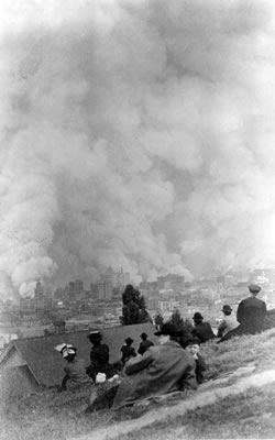
By then the fire had swept through 520 square blocks and incinerated close to 30,000 structures, including most of the city’s great mansions. Even ships were set afire by the embers and destroyed. Two hundred fifty thousand people were instantly homeless, bereft of savings (which burned up in banks), without water, and with almost nothing to eat. The entire economy was wrecked. For months, most San Franciscans lived, slept, and cooked outdoors. What had been ruined in three days would take a decade and longer to rebuild.
The 1906 Fire would have been a devastating blow to any city. But from its earliest days as a burgeoning city, albeit less than 60 years before, San Francisco was burned-down and quickly-rebuilt quite a few times. Holliday’s Rush to Riches describes how, in just 19 months between 1849 and 1851, the city endured either 6 or 7 “Great Fires,” depending on the definition. The San Francisco Daily Alta California saw the series of fires as being of biblical proportions. On May 4, 1851, they declared:
San Francisco is again in ashes. The smoke and flames are ascending from several squares of our city, as if the God of Destruction had seated himself in our midst, and was gorging himself and all his ministers of devastation upon the ruin of our doomed city and all its people.
While only a few survivors of those fires were still alive in 1906, the mid-1800s fires were already deeply-embedded in the city’s origin stories. This added to the trauma.
In the post-Gold Rush 1800s, San Francisco had done much to protect itself. But, with abundant timber nearby—outside of stone structures in the business district—it was still a mostly-wooden-building city. It was also in an earthquake zone, with a tiny watershed, and dry for long periods of the year, all increasing its vulnerability to fire. By 1906, in Kamiya’s words:
San Francisco’s firemen had been the pride of the city since the Gold Rush days, and the fire department one of the finest in the world. But the fire department was betrayed by the negligence of the city fathers … Fire chief Sullivan had pleaded with city officials for years to modernize San Francisco’s water system and stockpile dynamite that could be used to create firebreaks. But the corrupt and incompetent administration [of Schmitz, Ruef, and the Board of Supervisors] … so greedy that they would, in Ruef’s immortal phrase, “eat the paint off a house” … refused to allocate the money for the necessary improvements.
Marc Reisner is even more specific about prior fears that the city’s water system could not deal with a major fire. He writes that, just seven months before the 1906 Earthquake and Fire, the National Board of Fire Underwriters had warned that the city’s 36 million-gallons-a-day water system could not handle a big fire.
“San Francisco has violated all underwriting traditions and precedents by not burning up,” the report said. “That it has not done so is largely due to the vigilance of the fire department, which cannot be relied upon indefinitely to stave off the inevitable.”
While 36 million may sound like a lot of gallons-per-day, for a modern city of 400,000 in 1906, it was seen by most experts as insufficient. More and more dwellings in the city now featured indoor plumbing and running water, greatly increasing usage and the need for more water-supplies each year.
Reisner concedes that, even with three times as much water, much of the city would have burned. He thinks that the chaos, debris, horse-drawn and cable-drawn equipment climbing steep streets, and bad decisions made much of it inevitable. And, of course, many water mains had broken in the earthquake.
Still, even a national group of underwriters agreed that Fire Chief Dennis Sullivan (who died in the disaster) was correct in calling for more water capacity and better water infrastructure. Sullivan’s call would be heeded, but not before his death, the death of about 3,000 other San Franciscans, and the obliteration of half of America’s 10th biggest city.
The world, however, did not know of the death toll of 3,000 until over 70 years later. For most of the 20th Century, the death toll was put at less than 500. As Kamiya puts it, “This low figure served the needs of city officials and businessmen, who as soon as the flames were out began trying to convince the world that all was well.” It was not until 1980 that a researcher named Gladys Hansen compiled a list of victims that raised the toll nearly seven-fold to roughly 3,000.
One way to convince the outside world that “all was well” was to unite more civic leaders and business interests behind the push to build a dam in Yosemite National Park’s Hetch Hetchy Valley. It could multiply the city’s water supply and even make San Francisco a major water exporter to nearby Bay Area communities. Kuchera states that the Earthquake and Fire “played into reformers’ hands.” He writes that:
Their Progressive ideas combining efficiency and science attracted civic, business, and labor leaders to unite in an expansive, but thought-out plan for San Francisco. This vision gained steam in 1910 and 1911 when the city’s influential citizens successfully lobbied Congress to select San Francisco, not New Orleans, as the site of the Panama Pacific International Exposition in 1915. … Also in 1910 city voters overwhelmingly (95%) approved a bond to finance the construction of the water works necessary for the storage and delivery of water from Hetch Hetchy Valley to the Bay Area.
The main remaining opposition was what I would call a prime example of “Politics makes strange bedfellows.” One anti-dam-in-the-Park faction was the Sierra Club, led by John Muir, fighting it on environmental and preservationist grounds. The other was the privately-owned Spring Valley Water Company, hoping to preserve its San Francisco water-monopoly. But, once the Earthquake and Fire occurred, it was only a matter of time before they would lose. The push from local elites and a near-unanimous 95% of San Francisco voters—joined with generalized national sympathy, in the wake of the Earthquake and Fire—made it almost inevitable.
In 1913, the new Progressive Democratic administration of President Woodrow Wilson took office. As Interior Secretary, Wilson appointed William Lane of San Francisco. This stopped the “seesaw” ride in the Interior Department. As Kuchera notes, “Lane had been the city attorney for San Francisco under former mayor James Phelan and was very unambiguous about Hetch Hetchy.”
By this time, the state had already elected Progressive Republican Governor Hiram Johnson in 1910. An attorney, he had, among other things, assisted in the criminal graft prosecutions of Boss Ruef and Mayor Schmitz. Progressivism, at all levels, was now at high tide. Citing Cherny, Kuchera describes how local and national politics aligned in 1913:
The newly elected mayor of the city, James Rolph, saw the opportunity to fulfill one of his campaign promises that Progressives had long wanted. His “city attorneys drafted a bill, Democratic Congressman John Raker (another political ally of Phelan, whose district included Hetch Hetchy) introduced it” and prominent San Franciscans lobbied Congress to pass the bill. … Congress passed the Raker Act that year and President Wilson signed it.
The Raker Act authorized damming the Tuolumne River inside the National Park, drowning the scenic Hetch Hetchy Valley, and for San Francisco to build and control this huge water and hydroelectric asset. (The fixed lease amount to control a huge area of a National Park was also ridiculously low, reflecting San Francisco’s political influence.)
The Raker Act was a huge victory for San Francisco’s civic leaders. But, far upstream, Congressman Raker also had his reasons for celebrating. For this would be a truly massive multi-county construction project. And, even after it was built, there would be many permanent jobs making the big, complex system function as planned. There would be jobs in many counties, as the project spanned most of the width of the state, from east to west. But in the sparsely-populated Sierra Nevada counties, the employment effect was heightened.
Kenneth Brower summarizes the up-country effect, writing that “The project brought a new gold rush to the western slope of Yosemite and the foothills below, the country where the original gold rush had petered out half a century before.”
The Raker Act, of course, “paved” the way to eventual construction of the big concrete dam in Yosemite.
San Francisco’s “Water Race” with Los Angeles for Pacific Coast Supremacy
Since my Sierra College Press colleague and friend Gary Noy and I chose writers for our 2010 book, The Illuminated Landscape: a Sierra Nevada Anthology, a phrase has haunted me. It was part of our selection from Marc Reisner’s A Dangerous Place. The phrase was “Theodore Roosevelt’s warrior interest in populous cities at America’s western flank.” For the man who camped in Yosemite with Muir, championed parks, and made “Progressive” a household word, was also the warrior who charged up San Juan Hill in Cuba. And San Francisco and Los Angeles were both on America’s western flank and both vying for West Coast supremacy.
 In San Francisco, James Rolph—a masterful and inclusive politician with a reputation for getting things done—kept getting re-elected as mayor until he left to become the state’s governor. In California: a History, Kevin Starr writes of one of Rolph’s proudest moments:
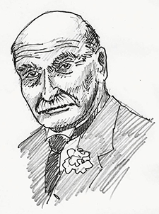
On July 7, 1923, San Francisco mayor James “Sunny Jim” Rolph dedicated the O’Shaughnessy Dam, named in honor of the city’s chief engineer; it took another eleven years (and ninety lives) to complete the four dams, the five reservoirs, the hydroelectric power plant, the nearly one hundred miles of pipeline, and the sixty-six miles of tunnel needed to conduct the waters of the Tuolumne to San Francisco.
Rolph would oversee almost all of the lengthy project. He died in the summer of 1934, during his first term as California’s Governor, knowing that water from Hetch Hetchy would finally reach San Francisco within a few months.
As for the dam’s opponents, John Muir died in 1914, just over a year after passage of the Raker Act. The Sierra Club, over the decades, grew exponentially in membership and geographic reach, and won many battles. But it was never able to stop the Hetch Hetchy project or breach it, once built.
The Spring Valley Water Company, however, kept its monopoly for over two decades after the Earthquake and Fire.
Despite a clear and ongoing majority of San Franciscans favoring municipalization, buying the Spring Valley system, and ending its city contract, the company held on. In 1910, on the same ballot as the Hetch Hetchy bonds, 65% of San Franciscans voted to purchase Spring Valley. This majority was, however, about 2% short of the [frankly anti-democratic, but historically-persistent-and-common] two-thirds majority required by law. In addition to outright opponents, a significant minority of city residents favored purchasing Spring Valley, but thought the asking-price too high. And it is the essence of understatement to say that Spring Valley drove a hard bargain on price. Kuchera writes of the electoral struggle over a couple of decades:
Four more times bond issues for this purpose failed in the 1910s and 1920s. …Finally 80% of city voters approved in 1928 and by 1930 the Board of Supervisors created the San Francisco Water Department.
So, by the time Hetch Hetchy municipal water first flowed into “The City” in 1934, Los Angeles had been drinking and using Owens Valley water for over 20 years, since 1913. Los Angeles leaders had been more-politically-unified on the water question and pushed it through rapidly. Meanwhile, Los Angeles had municipalized its water system even before that time. San Francisco was way behind.
In 1907, according to Kahrl, even before the Owens River project came online, Los Angeles would already offer dramatically lower water rates to customers. While San Francisco paid 24 cents per 1,000 gallons (and Oakland, Berkeley, and Alameda even more), Los Angeles customers’ rates had been cut to 10 cents. This was, of course, a huge competitive advantage in attracting businesses (especially water-intensive ones) and even in attracting new residents.
There were other competitive advantages for Los Angeles, as it tried to overtake San Francisco as the leading city of the American West. For one, Los Angeles could, and did, expand its borders by annexing large nearby rural areas, mainly in the San Fernando Valley. Between the 1910 and 1920 censuses, it more than tripled its area, from 99 square miles to 365 square miles. Los Angeles went from double “The City’s” area to over 8 times its area in that decade.
San Francisco—hemmed in by saltwater and the San Mateo County line—could not get geographically bigger. Then in 1906, of course, the San Francisco Earthquake and Fire had destroyed half the city, forcing many people to, at least temporarily, relocate until the city was rebuilt. Some of the businesses and residents never returned.
Still, obtaining abundant much-cheaper water for over two decades before its big rival was also a big advantage for Los Angeles. It is, perhaps, not entirely coincidental that Los Angeles’ population overtook San Francisco during this extended period of “water advantage.” According to the U.S. Census lists of the “100 Largest Urban Places,” in 1890 San Francisco was ranked the 8th largest city in the nation, while Los Angeles was #57, with roughly one-sixth San Francisco’s population. By 1900, Los Angeles was still only #36 to San Francisco’s #9. By the next census, though, San Francisco would be hearing “footsteps” of its southern rival.
After the Earthquake and Fire, San Francisco fell out of the Top Ten in 1910, never to return, but still #11, ahead of Los Angeles’ rapidly-advancing #17. By 1920, Los Angeles had entered the Top Ten at #10, edging San Francisco at #12. And by 1930, the last census of its pre-Hetch Hetchy “water advantage,” Los Angeles was #5 to “The City’s” #11 and almost double its population. (The momentum established in those decades would continue to the present. San Francisco was #13 in 2010, while Los Angeles passed America’s long-established “Second City” of Chicago in the 1990 Census and remains #2 today, behind only New York City.)
In the late 1800s and early 1900s there was certainly a sense among civic leaders, all around the United States, that “bigger was better.” And after 1906, there was a feverish effort among influential San Franciscans to rebuild “The City” both bigger and better. They also hoped to retain their primacy among the West’s big cities. The pioneer spirit was still alive but now often acted out by “conquering nature” on an epic engineering scale. The Hetch Hetchy project would be even grander than arch-rival Los Angeles’ Owens Valley aqueduct.
Kevin Starr writes of the “almost equally monumental damage to the environment” wrought by the far-reaching water projects of San Francisco and Los Angeles. He refers to “the loss of the magnificent Hetch Hetchy Valley” in the National Park. And he mentions “the dessication and devastation of the once-fertile Owens Valley when the Owens River was siphoned off to Los Angeles.” Starr also notes the ongoing legacies of both projects. He writes that they were “plagued by claims of deception, double-dealing, and conflict[s] of interest that became the subject of many histories, novels, and films—to include the Oscar-winning Chinatown (1974)—in the decades to come.”
Unfortunately, a big part of the race to be the American West’s premier city was run in some of the most majestic parts of the faraway Sierra Nevada.
Still, Why Build a Big Dam in Yosemite National Park?
To many modern observers, it seems incredible—to some of us, virtually obscene—that a major dam exists in a very scenic area of a National Park.
I think the historical record indicates that San Francisco needed the water to continue growing. And all big cities, especially back then, wanted to grow. Also, given “The City’s” tiny watershed, it was logical to seek water from the Tuolumne or some other Sierra Nevada river. Still, why was it not built lower on the Tuolumne River, outside the Park? In retrospect, I see several reasons why the dam was built in the Park.
Yosemite—so solidly established and beloved by millions from around the world today—had not yet achieved its widespread hallowed status in the late 1800s and early 1900s. In fact, it was still very loosely administered by a series of small U.S. Army units, including the famed African-American Cavalry unit known as the “Buffalo Soldiers.” The shape, size, usage, and administration (state or federal) of the Park was fluid. The National Park Service, formed in 1916, did not even exist yet when the Raker Act was passed in 1913. So the status of the Park and its boundaries were tentative and still “up for negotiation.”
Meanwhile, most Americans had seen paintings or photographs of Yosemite and many had read about its grandeur by 1913. But only a tiny percentage of citizens had ever seen Yosemite in person. Far from any big city, there was no easy way to get there. As late as 1914—before long automobile trips were that common—there were only 15,000 visitors to Yosemite. That was a far cry from the over 4 million people who now visit the Park each year. The Park’s committed “constituency” was not yet that strong.
The 1890s and early 1900s were also a time when the United States became a wide-ranging collector of colonies, offshore from North America. In 1898, in the Spanish-American War where Theodore Roosevelt charged that hill in Cuba, our country seized island territories as far apart as Puerto Rico, Guam, and the Philippines. We also annexed the Hawaiian Islands that year. We then intervened militarily in many less-powerful countries in the early 1900s. We also encouraged a rebellion in Colombia, helped the breakaway province become the nation of Panama, and set up a U.S. “Canal Zone” across the middle of that new nation, before building one of the wonders of the modern world, the Panama Canal.
The “colonizing” spirit was not confined solely to the federal government. Big American cities were also expanding their borders, as Los Angeles did so dramatically in the 1910s. In the 1890s, New York City had even annexed the nation’s 4th largest city, Brooklyn, greatly boosting its area and population. San Francisco’s and Los Angeles’ incursions into, and long-term domination of, big swaths of the Sierra Nevada were in the spirit of these civic expansionist and “regional-imperialist” times.
Then there was also what you might call a frontier or pioneer spirit of “Showing Nature Who Is Boss.” Ken Brower describes the huge Hetch Hetchy system as an “engineering marvel.” He then adds:
Many understood at the time, and historians are now nearly unanimous in retrospect, that it need not have been so marvelous. There were better, smarter, simpler, lower places for San Francisco to have stored its Sierra Nevada water.
Brower concludes that, for the past 80 years, the dam has stood as either an “elegant solution or a monument of inappropriate technology.” He, of course, thinks it is the latter, since his book is titled Hetch Hetchy: Undoing a Great American Mistake.
Sadly, the magnificence of the site—by the Grand Canyon of the Tuolumne in Yosemite National Park—was probably part of its appeal for the dam’s proponents. It was an era of daring to build public works “for the greater good” on an epic scale. It was also surely a product of a much-less-environmentally-aware time.
The project would be a heroic conquest of man taming nature. The Hetch Hetchy dam and system would be a mighty triumph for the mentality that John Muir called “Lord Man.”
Images Credits
- Spectators sitting on hillside watching fires consume the city after the 1906 San Francisco earthquake: Genthe, Arnold, 1869-1942, Library of Congress
- Michael O'Shaughnessy
sketch by Joe Medeiros
- Book covers, Heyday Books