A Field Trip Transect of the Northern Sierra Via Interstate 80
Richard P. Hilton
Dept. of Geosciences, Sierra College
Introduction
The geology of western North America, and especially the Sierra Nevada, has to rank as some of the most interesting but also some of the most complex geology in the world.
This description and road log is written not for the expert in Sierran geology but for the novice in hopes that it will make some sense to a wide-range of people with various amounts of geological expertise.
Click on the images
for larger versions.
The northern Sierra NevadaMountains adjacent to Interstate Highway 80 consist of two regimes of rocks.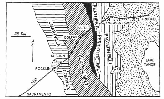 The older rocks (Paleozoic and Mesozoic), sometimes referred to as the Subjacent or basement rocks, consist primarily of various groups of rocks that were formed in a marine (ocean) environment (e.g., sea floor shales, sandstones, volcanics). These materials were heated and pressed until the mid-Cretaceous and hence today are largely low grade metamorphic rocks. These rocks were also intruded by granitic rocks in Jurassic and Cretaceous times. The granitic rocks that make up the Sierra Nevada Batholith have been exposed by erosion that stripped away most of the older metamorphic materials. Occasionally remnants of the older metamorphic rocks are found as roof pendants or where erosion has not been so severe.In the northwestern corner (northern foothills area) of the Sierra where the uplift and tilt was minimal, these rocks are relatively low and a large mass of the metamorphic rocks still survive. All of these rocks were deformed and metamorphosed in the Late Jurassic during the Nevadan Orogeny.
The second major regime of rocks lies unconformably on top of the older metamorphic and granitic rocks and is sometimes referred to as the Superjacent rocks as they are superimposed upon the older rocks. The Superjacent rocks are relatively flat-lying (~3 degree tilt) and consist primarily of river and volcanic deposits lying on top of the old erosion surface. ![]() For a mental picture of the two groups of rocks picture the older
metamorphic and granitic rocks as a marble cake and the younger overlying river and volcanic deposits as the frosting (no frosting on sides of cake). The kids have been sneaking the frosting as much of it is eroded away.
For a mental picture of the two groups of rocks picture the older
metamorphic and granitic rocks as a marble cake and the younger overlying river and volcanic deposits as the frosting (no frosting on sides of cake). The kids have been sneaking the frosting as much of it is eroded away.
How It Got This Way
Our ideas on how this part of the world got this way have changed dramatically over the last three decades. We not only picture drifting continents and ocean floors but now smaller slices of crustal material that we call terranes. Most of us agree that westernmost North America is made of add-on materials that have been either scraped off the ocean crust, are part of the ocean crust or are island arc assemblages that came rafting along with the ocean crust. All of this was merged into North America like when the janitor cleans up after a basketball game. The dust broom is North America, the dust is scraped up ocean sediment, and the discarded hot dog buns and cups are equivalent to the island arcs and other crustal fragments and debris.
The Simplified Story
 The history for this portion of the Sierra Nevada begins in the early Paleozoic when this area was offshore from ancestral North America in an environment much like the offshore Atlantic coast today. This area of the Sierra was receiving sediment from the older continental mass to the east. Beginning in mid Paleozoic time and lasting until near the close of the Mesozoic a long series of both ocean floor and volcanic island arc materials was accreted to and deposited against the western edge of this initial continent, building it westward and adding girth. By Late Jurassic-Early Cretaceous time a mountain range resembling the Andes was at the present site of eastern California and western Nevada. This mountain range was made of the accreted and deposited materials that had undergone and was undergoing significant folding, faulting and metamorphism from the mostly compressional events in its long history. It also was being intruded from a subduction zone below by large masses of magma that were to coalesce and become the granitic rocks that make up the Sierra Nevada Batholith. These granitic bodies cooled and solidified miles beneath the surface of the mountain range.
By the close of the Mesozoic much of the mountain range had been eroded and deposited to the west and marine sediments were lapping upon the Sierra's western flanks. Volcanism ceased for about the first half of the Cenozoic while rivers continued their erosion and subsequent deposition at the Sierra's west edge. Beginning in mid-Cenozoic time renewed volcanism began to bury the Sierra in volcanic debris. About 5 million years ago the rolling hills that were the Sierra broke with normal faults just to the east of the present Sierra crest and the block of rock that is now the Sierra Nevada Mountains began to uplift and tilt to the west. Rivers cut away much of the older river gravels and the later volcanics deposited over them, and incised deep V-shaped canyons. As time went on and the mountains grew higher, the climate swings of the Pleistocene ice ages caused the higher portions to be sculpted by glacial ice and the V-shaped valleys were scoured to u- shaped troughs. As the climate warmed waters filled the glacial depressions and once again the rivers flowed off the high Sierra. The plants climbed up and Muir's "Range of Light" was complete.
Road Log
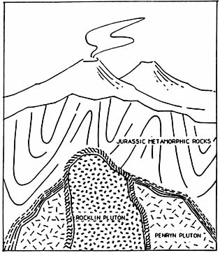 Where 1-80 crosses Rocklin Road we enter the Loomis Basin, the low area in which 1-80 passes between Rocklin and Newcastle. We will be paralleling Secret Ravine Creek as we go east. The bedrock in the creek is the granitic rock of the Rocklin and Penryn Plutons (large masses of solidified magma). The contact of these two plutons extends through the Sierra College campus (NW-SE) as evidenced by the numerous pegmatite dikes where the Rocklin Pluton intrudes the Penryn Pluton. It was once a liquid magma that intruded into this area about 128 million years ago. At that time this area was the core of a mountain range that would have resembled the Andes or the Cascades of today. This quartz diorite would have been a large liquid mass of magma, miles across, intruding into older (Jurassic) metamorphic rocks as well as the previously intruded (148 Ma.) Penryn Pluton. The older metamorphic rocks would have extended several miles above the liquid to the surface of the range.
Because the temperatures and pressures were high at this depth (8-12 km), the crystals in this granitic rock had time to grow to sizes easily seen by the unaided eye. Hence they tend to sparkle from the individual minerals in them.
Exit at Indian Hill Road Exit in Newcastle. Note granite (quartz diorite) in road cuts.
Proceed east up Indian Hill Road. Notice metamorphic rocks of the Copper Hill "Volcanics" in the road cuts to our left.
Stop #1
Turn left up paved "driveway" and park. If we look over the Loomis Basin we can see that the tops of the hills and ridges all line up to form the remnants of the Miocene erosion surface. Although most of the erosion of this surface occurred by Paleocene or early Eocene, as evidenced by the Tertiary channels, erosion continued until late Oligocene- Miocene time when much of the Sierra Nevada became buried beneath volcanics. Hence we will refer to this erosion surface as a Miocene erosion surface in this road log.
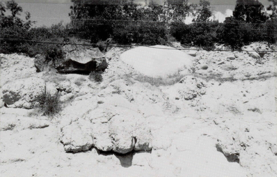
About five million years ago, the Sierra faulted on the east side near Donner Pass and began tilting to the west. It eventually was tilted to the west about 3 degrees and became incised by fluvial (river and stream) erosion. Locally this erosion surface is occasionally covered by the Mio-Pliocene volcanics of the Mehrten Formation that overlie the Jurassic metamorphic rocks and later granitic rocks of the Rocklin and Penryn Plutons. In the cut below, this forms a good example of a nonconformity (a buried erosion surface). 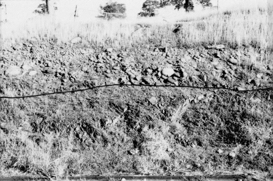 Here the andesitic fluvial conglomerates and tuffs (river gravels and volcanic ash) of the Mehrten Formation sit directly on the ancient river bed cut into the Jurassic rocks.
Proceed up Indian Hill Road to the east. If you look in the roadcut to the left, as we go by, you may notice that the andesitic conglomerate of the Mehrten Formation gives way to overlying lahars (volcanic mudflows).
Stop #2
At this stop we will be able to see some of the details of the lahars that cap the local doabs (gently sloping mesa-like hill between drainages). These volcanogenic mudflows flowed as relatively cool muds (as evidenced by fossil leaves and twigs) from the area that is today the Sierra crest. The slopes at that time were probably less than 1 degree. The mud was formed from volcanic ash that mixed with meteoric (rain) and/or ground water. Caught up in the mud we see angular blocks of andesite as well as some basalts and rhyolite (lava rocks). Occasionally metamorphic and granitic basement rocks can also be discovered in this otherwise andesitic breccia (broken angular rocks cemented together).
Proceed east on Indian Hill Road. Turn left on Auburn-Folsom Road. Note large boulders in cuts, transported by Mio-Pliocene lahars.
Enter "Old Town" Auburn. Auburn was originally called "North Fork Dry Diggins." The name Auburn was first used late in the year of 1849. The town was built in a haphazard way with the old paths of the pack animals later being paved for roads. With its altitude and pleasant climate Auburn became the place to "winter over." In winter miners would come out of the mountains and head back up at first thaw. Just before we come to the freeway, notice the old fire house on the left.
At the Lincoln Way sign, in the cut to the right notice the quartz vein. This marks the beginning of the Bear Mountain-Wolf Creek branch of the Foothill Fault System. The cuts to the right are mostly greenstone but there are occasional outcrops of serpentine as well, another sign that this is a fault zone. A more detailed discussion of serpentine will occur when we stop at an outcrop later in the trip. The Bear Mountain-Wolf Creek branch is approximately 3 km wide in the Auburn area. Although this is a very old fault, it is seismically active in this area northward toward Oroville, where in 1975 there was a damaging 5.7 quake.
Just after passing the Foresthill Exit, if we look off to the right we get our first view of the sloping "Miocene" erosion surface later incised by the American River. A quick look to the left and you might see a cut into Channel Hill where there is a good exposure of the Mio-Pliocene conglomerates, tuffs and lahars of the Mehrten Formation.
Stop #3: Frontage road between Clipper Gap and Applegate
 Here we see local pillow structure in the greenstone. This outcrop originated as basaltic lava that erupted beneath the sea. Due to the pressure and chilling nature of the seawater the lava did not flow like fluid basalts do on land but rather extruded more like toothpaste being slowly squeezed from a tube, piling up like worm castings the size of large pillows.
On the east side of the cut is a small block-glide type of mass wasting (landslide), that has slid partially down the slope on a joint.
Proceed to the town of Applegate. The town was originally called Bear River House but was renamed in 1855 after its first settler, Lisbon Applegate, who arrived here in 1849.
From here we proceed east on on I-80. For the next few miles weathered metasediments give the cuts a rusty reddish-orange appearance due to the higher rainfall and the acid nature of the pine needles that help to oxidize the iron in these rocks.
Exit at Weimar Crossroads to Ponderosa Way and make an immediate turn
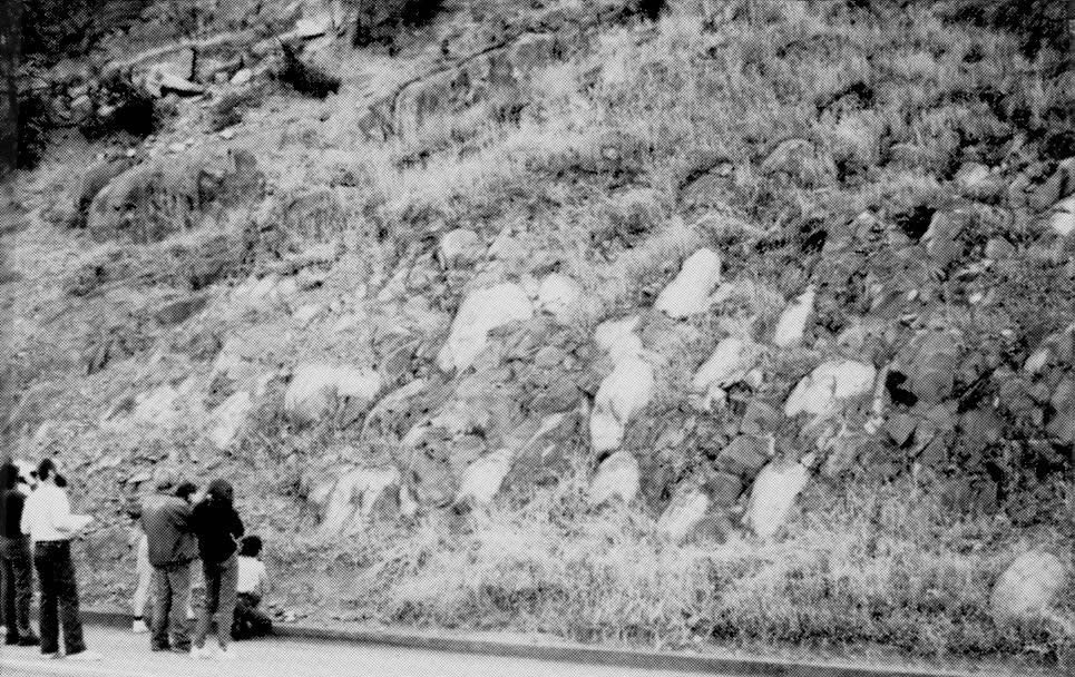
and go east. 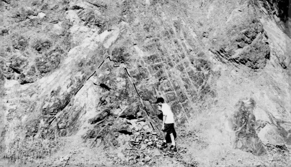 On the outside of a bend we will stop at a cut on the north side of the road to observe the chevron folds in the Jurassic Mariposa Formation. Some ammonites, cf. Perisphinctes and bivalves (fossil sea shells) have been collected from this cut. We will examine the cut and try to collect fossils here (they are very rarely found). Please be careful crossing the road and stay well away from the road.
At Colfax we will again join I-80. The town of Colfax was laid out by the Central Pacific Railroad in early 1865 and the railroad reached here on September 1st of that same year. Besides the railroad industry, rich gold-bearing quartz veins were soon discovered yielding $27 per ton which led to the opening of the Rising Sun Mine. Just past Colfax if you look off to the right you will get a glimpse of the American River Canyon and Cape Horn.
For the next few miles the numerous cuts expose mostly weathered metasediments, some intruded by quartz veins.
Stop #4: Exit at Gold Run Rest Stop
After a brief rest stop walk back towards the freeway off ramp and look across the freeway to see cross-bedded sands and gravels of the ancestral South Fork of the Yuba River. These deposits are the remains of a river that once flowed over this region during Eocene times (50 Million years ago), long before the uplift of the present Sierra Nevada. This ancient Eocene river, like many of the ancestral channels of the Sierra, may have had its headwaters in what is now Nevada.
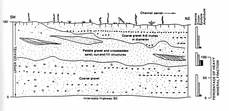 The gravel is approximately a mile wide in the east-west direction and 300 feet thick. What we see in the road cuts are just a portion of the upper set of two sets (a lower and upper) totaling about 400 feet thick. The lower gravel is much coarser and different in composition and was much richer in gold. It contains abundant boulders and cobbles, some of which are several feet in diameter. This unit is between 70-140 feet thick and was deposited when the area had a relatively high relief. In the upper gravels all but the most resistant clasts were either carried away in solution or were weathered into stable clay minerals. These deposits are composed of kaolinite clay, silt, quartz sand, and larger clasts of quartzite, metaconglomerate, milky white quartz, and even petrified wood. Recently, fossil Eocene leaves complete with DNA have been collected from this area for genetic studies. These fossils suggest a subtropical, warm humid climate during the time of deposition similar to that of Vera Cruz, Mexico of today.
By Eocene time the Andean type mountain range that had existed here during the Jurassic Period had largely been stripped away by erosion. The Eocene river sediments were deposited unconformably over the metasedimentary rocks. This excellent nonconformity can be seen here. Good exposures of lateritic soils on top of the cut show a characteristic bright rusty red color.
Here at the Stewart Hydraulic Mine in the Gold Run District, water was the method of extraction of gold. Water was piped from an uphill location and by the time it reached the giant nozzles (monitor, dictator) it had a pressure of about 125 pounds per square inch. A nine-inch monitor yielded about 30,000 gallons a minute, making it possible for two men working a single monitor to strip fifteen hundred tons of debris from a hillside in twelve hours. The water was simply sprayed onto the auriferous gravels and the river of debris was washed through riffles and sluices that were often heavily charged with mercury.
In this area (Dutch Flat and Gold Run), 233,000,000 cubic yards of material were washed into the rivers below and the average gold content of the gravels in this area was 11 cents/cubic yard. At the Stewart Hydraulic Mine, which was in operation from 1865-1878, 555 acres of land was stripped of its gravel to an average depth of 55 feet. Somewhere, between 3 and 6 million dollars worth of gold was extracted in the Gold Run area. In 1880 alone the combined flow of mining debris from the Sierra Nevada reaching the Great Valley below was 46 million cubic yards. In total, 146 million cubic yards of material eventually went into San Francisco Bay. As a result, one of California's first laws protecting the environment was passed in 1884; "the Sawyer decision," which effectively ended most hydraulic mining.
Now back onto eastbound I-80. Be looking in the cuts to your left at the excellent exposures of the Tertiary river deposits. In places the lower deposits appear much coarser than the upper deposits.
Exit at Alta. When the Central Pacific Railroad reached Alta in July of 1866 the town became a popular destination for people on day trips from Sacramento. With its dense conifer forests, lumber became its main industry.
We turn right and make an immediate left onto Casa Loma Road that parallels the eastbound lanes of I-80. Look across the freeway to the north at white Oligocene-Miocene rhyolitic tuffs of the Valley Springs Formation that overlie light brown clays (Tertiary?) and the Tertiary auriferous gravels. We now turn right and continue down Casa Loma Road just before railroad overcrossing. Note on the left just before we cross the creek that there is a deposit of large Mio-Pliocene andesitic river boulders of the Mehrten Formation.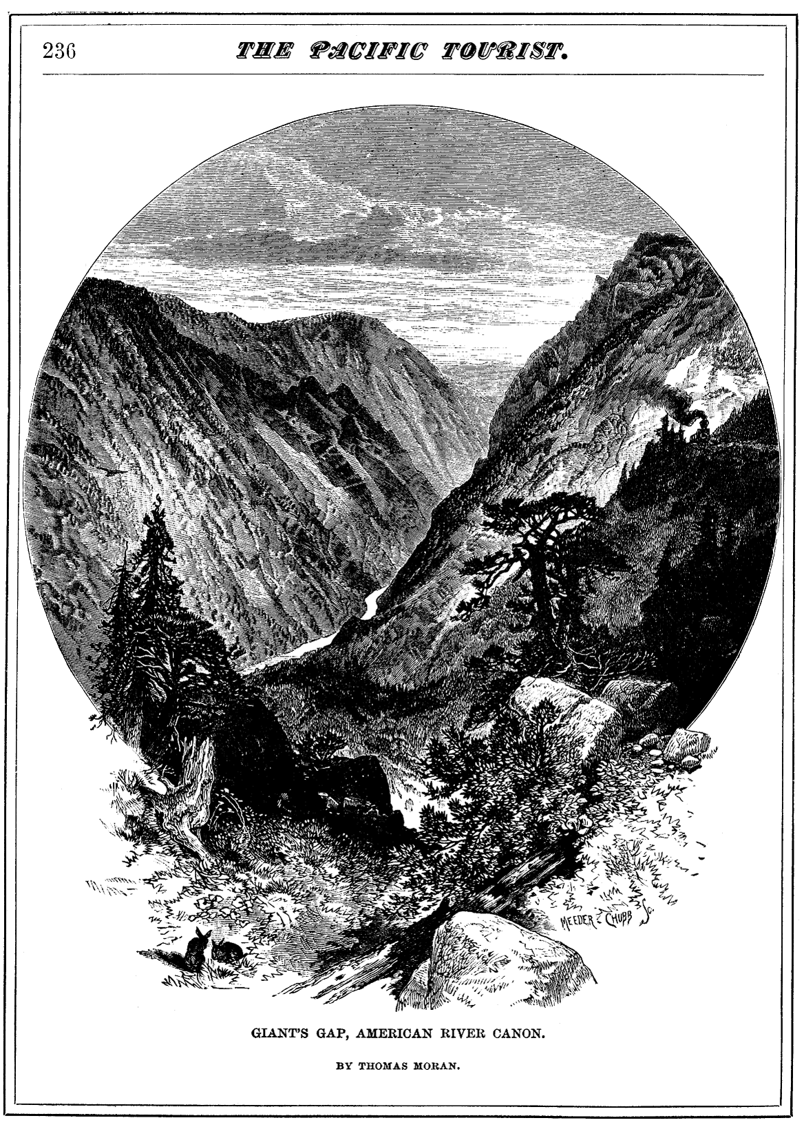 We cross railroad tracks (after stopping), and proceed through beautiful forest of Ponderosa Pine, Incense Cedar, Douglas Fir, Black Oak, Big Leaf Maple and Dogwoods. These are growing mostly on Mehrten Mio-Pliocene lahars.
Note the spring on the left at the contact with the lahars and the underlying serpentine in the Giant's Gap Fault of the Melones Fault Zone. The Giant's Gap Fault was active between 700,000 and 2,000,000 years ago as evidenced by the overlying Mio-Pliocene volcanics that have been offset as much as a few hundred feet.
Here also we break out of the forest into an entirely different type of vegetation growing on the serpentine.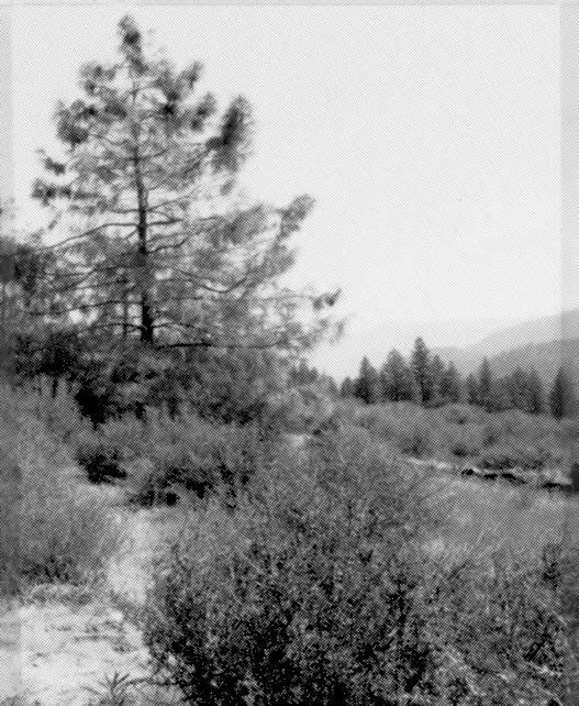
In the serpentine the predominent tree is the Foothill Pine growing with Buck Brush, a type of Ceanothus. Serpentine (serpentinite) is the state rock of California where it is found commonly in fault zones. Serpentine soils are toxic to most plants. Due to the high magnesium in the rock the plant has a hard time absorbing the calcium it needs. Heavy metals such as chrome and nickel are also a problem. Those that have evolved to live on it have little competition and many rare endemic plants in California grow only on serpentine.
Stop #5
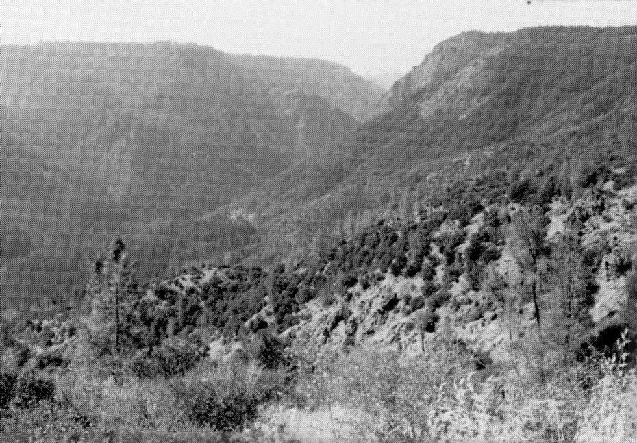 From here we will take a short walk down and across the tracks to view the V-shaped youthful canyon of the North Fork of the American River. Across the canyon we can see the flat "Miocene" erosion surface that was the dominant topography before the faulting and westward tilting of the Sierra occurred. Most of this faulting and tilting has occurred in the last 5 million years, hence this beautiful canyon has been eroded by the river in that time. Downstream to the right (west) we can see Giant's Gap, where the river has had to cut down through the more resistant Paleozoic greenstone and left a very rugged and narrow canyon.
From here we walk back to the vehicles and up on the road above to eat lunch and collect some of the hydrothermally deposited(?) green opal.
Lunch
After lunch we will backtrack to the freeway. Note slide area with rocks, gravel and drainage pipes on the north side of the freeway, below Oligocene-Miocene Valley Springs Formation. Starting at the Baxter Exit and for the next mile, the roadcuts to the left expose Oligocene-Miocene fluvial tuffaceous lacustrine(?) (lake bed) sediments, perhaps originally dammed by faulting downstream.
 Landslide area on left. This landslide blocked westbound I-80 Feb. 18, 1990 during a winter storm. The flume above the slide was damaged and may have been a contributing factor. The light-colored sandy material in the road cuts is sand left behind by snow plows blowing salty, granitic, sand-laden snow up and away from the highway. The salt often kills local trees along the highway and also contributes to cars killing the deer that come down to the highway edge to lick the salty pavement and sand.
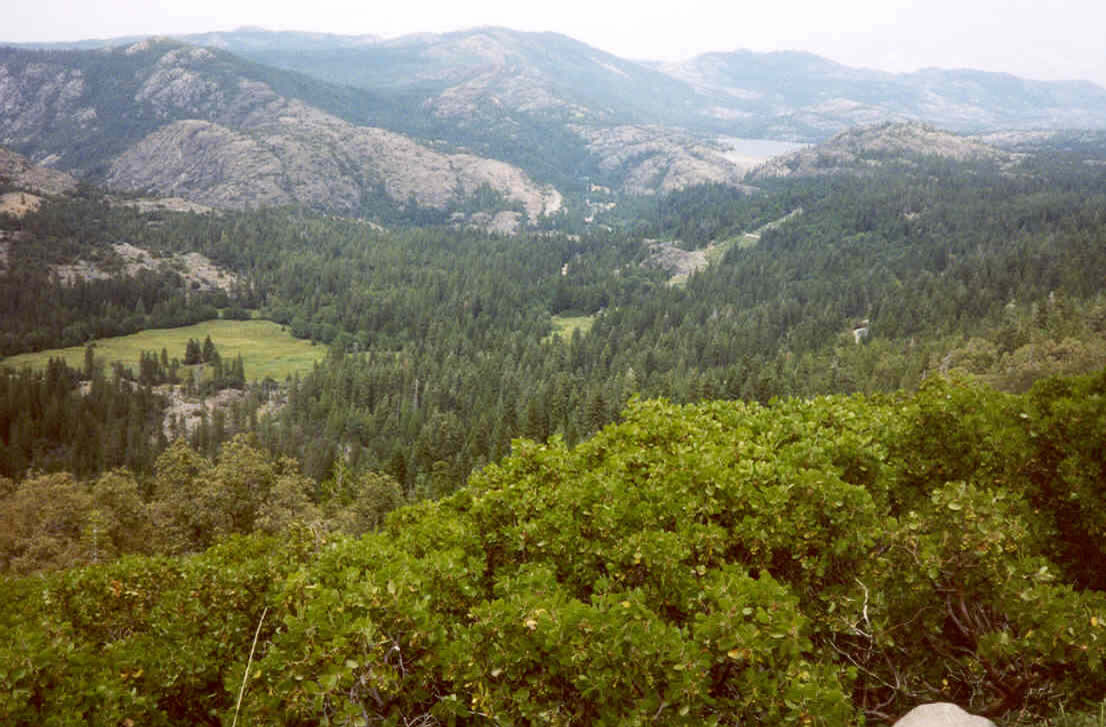
 At Blue Canyon we are on a ridge atop the old Miocene erosion surface with the glaciated Bear River drainage to the north (left) and a portion of the glacially altered American River drainage to the south (right). As we pass the Nyack Exit, the effects of glaciation become evident with the scoured bare rock landscape and U-shaped canyons. Notice the light-colored granitic erratics sitting atop the light brown Mehrten Formation on the left.
Stop #6
At Highway 20 intersection we stop and hike up a small dome in the granite. Highway 20 proceeds west through the gold rush towns of Grass Valley and Nevada City. Starting about here and to the east is a large biotite-hornblende granodiorite pluton (intrusive granitic rock). On the left is lake Spaulding and the long narrow ridge with the fire lookout beyond is Grouse Ridge. To the left on the divide between the valley occupied by Lake Spaulding and the valley up which the freeway proceeds there is a treeless ridge that is a medial moraine. This was left behind where each of the tributary glaciers that once fed these valleys converged.
Exit at Cisco and turn left. Go across the freeway and South Fork of the Yuba River. Turn right on Hampshire Road. Here we can see metasedimentary rocks of the lower to Middle Jurassic Sailor Canyon Formation. Lower Jurassic fossils have been found in the Sailor Canyon Formation. These rocks are part of the Cisco Grove roof pendant.
Proceed and pass under the westbound lanes of I-80. Note numerous granitic erratics (boulders left by glaciers) sitting on the metamorphic rocks of the Cisco Grove roof pendant.
 We pass the contact between metamorphic rocks of the Cisco Grove roof pendant and the lower Cretaceous grano-diorite just to the east of the junction of Hampshire Road and freeway access and continue east on Hampshire Road. We cross the North Fork of the Yuba River. Note the many excellent examples of xenoliths in the granodiorite. Xenoliths are inclusions of "foreign rocks" within a solidified magma. They probably
have several possible sources but many may be derived from fragments of the older rocks into which magma has intruded. These must have had a higher melting point than the magma but many have been highly altered due to the heat of the magma and had their sharp edges melted. This is much like the rounding of an ice cube as it melts in one's mouth.
We pass the contact between metamorphic rocks of the Cisco Grove roof pendant and the lower Cretaceous grano-diorite just to the east of the junction of Hampshire Road and freeway access and continue east on Hampshire Road. We cross the North Fork of the Yuba River. Note the many excellent examples of xenoliths in the granodiorite. Xenoliths are inclusions of "foreign rocks" within a solidified magma. They probably
have several possible sources but many may be derived from fragments of the older rocks into which magma has intruded. These must have had a higher melting point than the magma but many have been highly altered due to the heat of the magma and had their sharp edges melted. This is much like the rounding of an ice cube as it melts in one's mouth.
Stop #7: Loch Leven Trail Head parking area
 Restrooms available here. Walk to the west to the top of the dome. The porphyritic granodiorite contains numerous xenoliths. The dome itself is a product of exfoliation (sheeting) caused by unloading and the expansion of the rock at aright angle to the exposed surface, producing exfoliation joints (cracks) parallel to the surface of the rock.
This otherwise sparsely jointed portion of the granodiorite has been sculpted by the glaciers. Along the north portion of the dome we can see excellent examples of polish, striations, grooves and chatter marks left by the overriding glaciers and their clastic inclusions during the Pleistocene. Notice also the numerous erratics. If one looks to the east on top of the ridges one can see Plio-Pleistocene basalts that flowed over
the Miocene erosion surface. Further up 1-80 at the Soda Springs Exit we can see Castle Peak which is made almost entirely of these flows. Walk back to vehicles and continue east. 
Rejoin I-80 and continue east up the U-shaped valley of the upper South Fork of the Yuba. The transcontinental railroad is on the right. Notice Lodgepole Pines. This pine is found at high altitudes (~6,000 ft in central Sierra) and at high latitudes in North America.
At the 6,000 ft. marker we cross South Fork of Yuba River. Note the dome on the left (north) with the erratic on top of it.
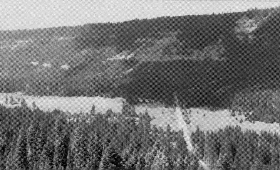
If you look on the tops of the ridge to the north (left) you will see Plio-Pleistocene basalt capping the granitic rocks. These basalts can be traced as far east as Fallon, Nevada. In places granitic erratics are sitting on top of the basalt indicating that the glaciers once spilled over this valley. The Pliocene basalt forms much of Castle Peak in the distance to the northeast. Exit at Soda Springs and turn right on old Highway 40 (ancestral I-80). Just past the Old Soda Springs Lodge the meadow and seasonal lake on the right (south) are produced by a moraine dam, in this case a recessional moraine. Railroad snow sheds begin on right. The valley here is rimmed by Mio-Pliocene stratified volcanogenic mudflows of the Mehrten Formation.
From here until the next stop at Sugar Bowl, notice the upper Oligocene to lower Miocene rhyolite ashfall tuffs of the Valley Springs Formation in the roadcut to your left. These have been dated at between 26 and 33 million years old. On the left side of the road we again see the Oligocene to lower Miocene rhyolite ash flow tuffs (Valley Springs Formation). Rhyolite tuffs of this age thicken to the east and can be found from the Sierra foothills in the west, far into Nevada to the east. Their source appears to be east of the present Sierra crest and they are among the oldest widespread volcanics in the Sierra. Notice also the abundant Pleistocene glacial tills.
On the right, south of the Sugar Bowl Parking lot, we can see Miocene stratified mud flows of the Mehrten Formation. Eocene fluvial sandstones, some containing fossil leaves lie stratigraphically between the Miocene volcanogenic materials and the underlying granitic rocks.
Stop #8: Old Donner Pass (elevation 7088)
 This is a major divide in the watershed of the area, and during the Pleistocene this was the approximate boundary between the flow of glaciers that flowed into drainages to the east and west. Today the water that falls on the east side of the range flows into the drainage of the Truckee River, which eventually makes its way to Pyramid Lake in Nevada north of Reno.
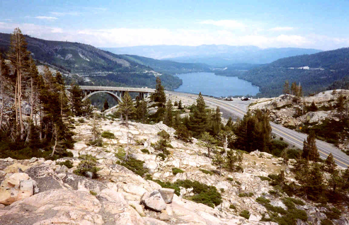
Pyramid Lake is located in one of the many grabens of the Basin and Range Province. The water that flows off the west side of the range flows into the Yuba River, which eventually enters into the Sacramento River drainage and on into the Pacific. 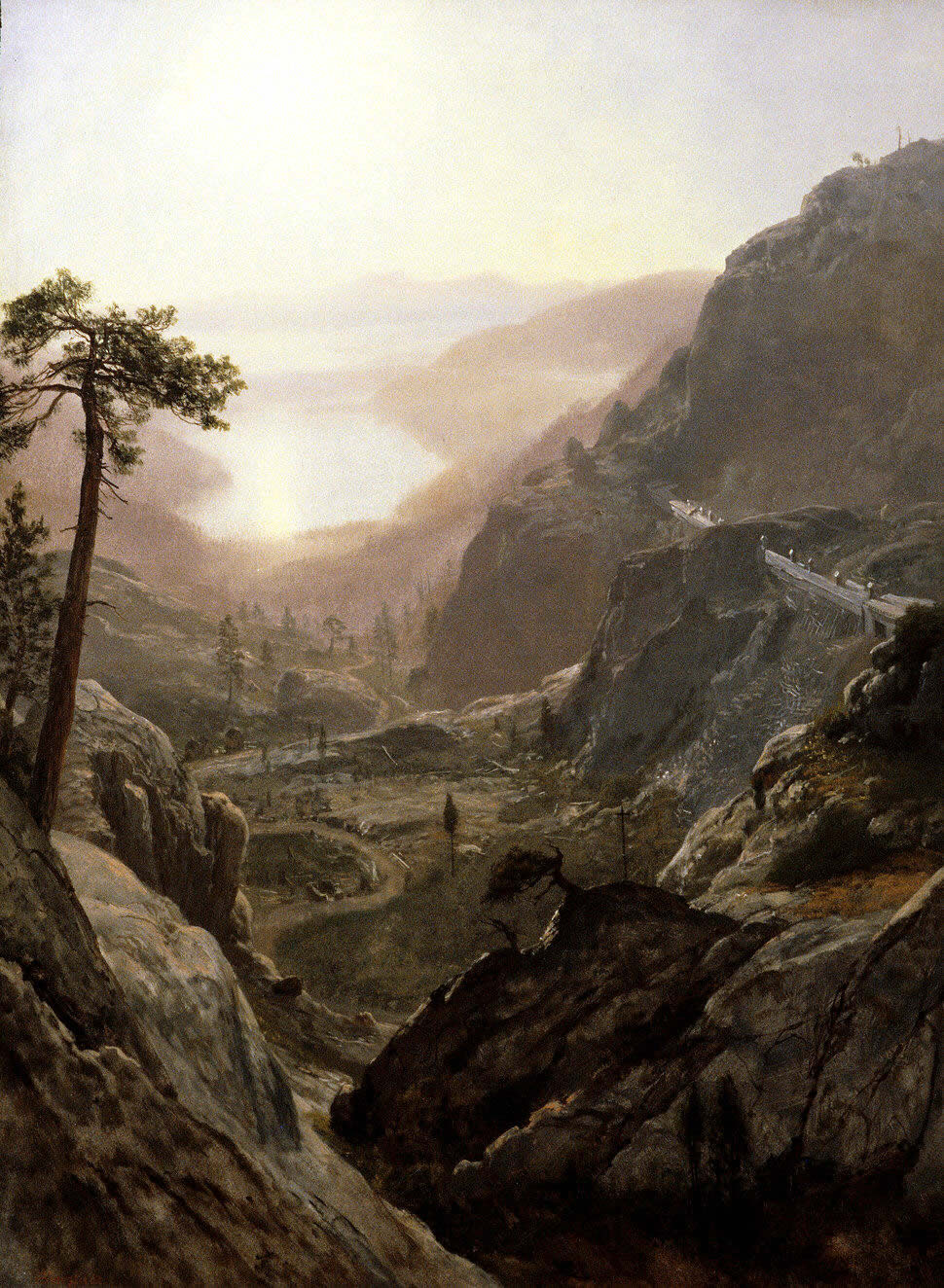 Here we have a magnificent view of the Donner Lake Basin, named for the ill-fated Donner Party that was trapped here by winter snows in the winter of 1846-47; forty-two people died. This U-shaped glacial valley has lateral moraines on both sides and a recessional moraine forms the dam behind which Donner Lake lies. The glaciers here flowed generally off the steep eastern slope of the Sierra into the Truckee River drainage. This steep slope is formed by the Sierra Front Range Fault, a normal fault that separates the Sierra from the Basin and Range Province to the east. The granodiorites and overlying volcanics here have been offset normally by as much as 1,800 feet. Above the transcontinental railroad (cut into the granodiorites in the 1860s), one can see an excellent example of a fel-se-mer (sea of stones), which are the ice-wedged angular rocks that litter the peak above.